Blairstown
Airport details
| Country | United States of America |
| State | New Jersey |
| Region | K6 |
| Airspace | New York Ctr |
| Municipality | Blairstown |
| Elevation | 372ft (113m) |
| Timezone | GMT -5 |
| Coordinates | 40.97113, -74.99751 |
| Magnetic var | |
| Type | land |
| Available since | X-Plane v10.40 |
| ICAO code | 1N7 |
| IATA code | n/a |
| FAA code | 1N7 |
Communication
| Blairstown CTAF/UNICOM | 123.000 |
| Blairstown ALLENTOWN Approach Departure | 119.650 |
| Blairstown NEW YORK Approach/Departure | 127.600 |
Nearby Points of Interest:
Blairstown Historic District
-Fairview Schoolhouse
-Sunfish Pond
-Warrington Stone Bridge
-John Michael Farm
-John Turn Farm
-Cold Spring Farm Springhouse
-Worthington Hall
-Shawnee-Minisink Site
-Schoonover Mountain House
-Casper and Abraham Shafer Grist Mill Complex
-Capt. Jacob Shoemaker House
-Harmony Hill United Methodist Church
-Great Meadows Railroad Station
-Old Mine Road Historic District
-Turn Store and the Tinsmith's Shop
-Peters House
-Minisink Archaeological Site
-Monroe County Courthouse
-Rutherfurd Hall
-Warren County Courthouse
-Mount Bethel Methodist Church
-Shippen Manor
-Oxford Furnace
-Oxford Industrial Historic District
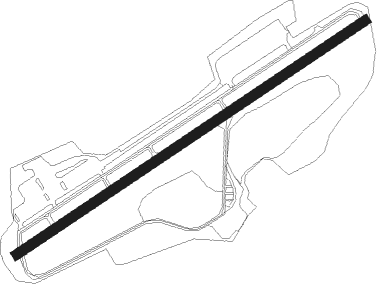
Runway info
| Runway 7 / 25 | ||
| length | 949m (3114ft) | |
| bearing | 67° / 247° | |
| width | 21m (70ft) | |
| surface | asphalt | |
| displ threshold | 98m (322ft) / 75m (246ft) | |
Nearby beacons
| code | identifier | dist | bearing | frequency |
|---|---|---|---|---|
| STW | STILLWATER VOR/DME | 6 | 79° | 109.60 |
| BWZ | BROADWAY (SCHOOLEY'S MT) VOR/DME | 13 | 135° | 114.20 |
| SAX | SPARTA VORTAC | 21.5 | 78° | 115.70 |
| FJC | ALLENTOWN VORTAC | 25.4 | 242° | 117.50 |
| SBJ | SOLBERG VOR/DME | 26 | 147° | 112.90 |
| CAT | CHATHAM NDB | 29.2 | 112° | 254 |
| MM | MOREE (MORRISTOWN) NDB | 30.5 | 98° | 392 |
| HUO | HUGUENOT VOR/DME | 32 | 43° | 116.10 |
| LVZ | WILKES-BARRE VORTAC | 36.1 | 294° | 111.60 |
| ETX | EAST TEXAS VOR/DME | 39 | 240° | 110.20 |
| TE | TORBY (TETERBORO) NDB | 40.5 | 101° | 214 |
| TEB | TETERBORO VOR/DME | 43 | 97° | 108.40 |
| ARD | YARDLEY VOR/DME | 43.3 | 173° | 108.20 |
| SW | NEELY (NEWBURGH) NDB | 46.5 | 56° | 335 |
| RBV | ROBBINSVILLE VORTAC | 51.5 | 147° | 113.80 |
| PTW | POTTSTOWN VORTAC | 51.7 | 217° | 116.50 |
| ING | AMBLER NDB | 52.4 | 199° | 275 |
| SKU | STANWYCK (NEWBURGH) NDB | 54.4 | 60° | 261 |
| COL | COLTS NECK VOR/DME | 55 | 128° | 115.40 |
| GXU | MC GUIRE (WRIGHTSTOWN) VORTAC | 60.5 | 157° | 110.60 |
| NEL | LAKEHURST NDB | 63.3 | 144° | 396 |
Instrument approach procedures
| runway | airway (heading) | route (dist, bearing) |
|---|---|---|
| RW07 | KIMKE (47°) | KIMKE ZUCRY (5mi, 323°) 3200ft |
| RW07 | NOBCI (84°) | NOBCI ZUCRY (5mi, 143°) 3200ft |
| RW07 | ZUCRY (67°) | ZUCRY 3200ft |
| RNAV | ZUCRY 3200ft CETZO (4mi, 67°) 2700ft VETSY (2mi, 67°) 2400ft 1N7 (6mi, 67°) 406ft (4728mi, 119°) 772ft ZUCRY (4738mi, 299°) 3200ft ZUCRY (turn) | |
| RW25 | BWZ (315°) | BWZ MEVNE (12mi, 27°) 3000ft IBIYU (5mi, 324°) 3000ft |
| RW25 | COATE (241°) | COATE IBIYU (6mi, 228°) 3000ft |
| RW25 | SAX (258°) | SAX IBIYU (11mi, 269°) 3000ft |
| RNAV | IBIYU 3000ft FAPAV (6mi, 247°) 2100ft 1N7 (6mi, 247°) 411ft (4728mi, 119°) 780ft COATE (4717mi, 299°) 3000ft COATE (turn) |
Disclaimer
The information on this website is not for real aviation. Use this data with the X-Plane flight simulator only! Data taken with kind consent from X-Plane 12 source code and data files. Content is subject to change without notice.