Kelseyville - Lampson Fld
Airport details
| Country | United States of America |
| State | California |
| Region | K2 |
| Airspace | Oakland Ctr |
| Municipality | Lake County |
| Elevation | 1379ft (420m) |
| Timezone | GMT -8 |
| Coordinates | 38.99061, -122.90072 |
| Magnetic var | |
| Type | land |
| Available since | X-Plane v10.40 |
| ICAO code | 1O2 |
| IATA code | n/a |
| FAA code | n/a |
Communication
| Lampson Fld AWOS-3 | 118.350 |
| Lampson Fld CTAF/UNICOM | 122.800 |
Nearby Points of Interest:
Lakeport Carnegie Library
-Old Lake County Courthouse
-Healdsburg Carnegie Library
-madrona manor
-Healdsburg Memorial Bridge
-Cunningham-Hembree Estate
-Pond Farm
-Sam Brannan Cottage
-James H. Francis House
-James H. and Frances E. Laughlin House
-Condominium 1
-Laguna de Santa Rosa
-Schramsberg Vineyards
Runway info
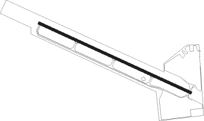
| Runway 10 / 28 | ||
| length | 1096m (3596ft) | |
| bearing | 113° / 293° | |
| width | 18m (60ft) | |
| surface | asphalt | |
| displ threshold | 0m (0ft) / 26m (85ft) | |
| blast zone | 0m (0ft) / 76m (249ft) | |
Nearby beacons
| code | identifier | dist | bearing | frequency |
|---|---|---|---|---|
| ENI | MENDOCINO (UKIAH) VORTAC | 17.8 | 280° | 112.30 |
| UK | KEARN (UKIAH) NDB | 23.3 | 310° | 371 |
| STS | ROSA DME | 29.2 | 169° | 116.15 |
| ILA | WILLIAMS VORTAC | 41 | 85° | 114.40 |
| SGD | SCAGGS ISLAND (NAPA) VORTAC | 54.6 | 147° | 112.10 |
| PYE | POINT REYES VOR/DME | 54.7 | 178° | 113.70 |
| SUU | TRAVIS (FAIRFIELD) TACAN | 63.3 | 128° | 116.60 |
| CCR | CONCORD VOR/DME | 69.5 | 138° | 117 |
Departure and arrival routes
| Transition altitude | 18000ft |
| Transition level | 18000ft |
| SID end points | distance | outbound heading | |
|---|---|---|---|
| RW10 | |||
| LAKPT3 | 18mi | 280° | |
Instrument approach procedures
| runway | airway (heading) | route (dist, bearing) |
|---|---|---|
| RWNVA | ENI (100°) | ENI SAVPE (15mi, 63°) 6700ft TAPNE (5mi, 90°) 5800ft |
| RWNVA | WEPLO (142°) | WEPLO SAVPE (5mi, 121°) 6700ft TAPNE (5mi, 90°) 5800ft |
| RNAV | TAPNE 5800ft NADIE (6mi, 180°) 4700ft MUFEL (6mi, 180°) 2580ft (6905mi, 108°) 2580ft WEPLO (6908mi, 288°) 8000ft WEPLO (turn) |
Disclaimer
The information on this website is not for real aviation. Use this data with the X-Plane flight simulator only! Data taken with kind consent from X-Plane 12 source code and data files. Content is subject to change without notice.