Brookhaven - Brookhaven-lincoln County
Airport details
| Country | United States of America |
| State | Mississippi |
| Region | K7 |
| Airspace | Houston Oceanic Ctr |
| Municipality | Brookhaven |
| Elevation | 486ft (148m) |
| Timezone | GMT -6 |
| Coordinates | 31.60583, -90.40930 |
| Magnetic var | |
| Type | land |
| Available since | X-Plane v10.40 |
| ICAO code | 1R7 |
| IATA code | n/a |
| FAA code | n/a |
Communication
| Brookhaven-Lincoln County AWOS 3 | 118.125 |
| Brookhaven-Lincoln County CTAF/UNICOM | 122.800 |
Nearby Points of Interest:
Mississippi Mills Packing and Shipping Rooms
-Lawrence County Courthouse
-Union Church Presbyterian Church
-William Frederick Holmes House
-Magnolia Depot
-Jefferson Davis County Courthouse
-Wolfe House
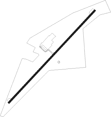
Runway info
| Runway 4 / 22 | ||
| length | 1525m (5003ft) | |
| bearing | 52° / 232° | |
| width | 23m (75ft) | |
| surface | asphalt | |
| displ threshold | 193m (633ft) / 305m (1001ft) | |
Nearby beacons
| code | identifier | dist | bearing | frequency |
|---|---|---|---|---|
| MCB | MC COMB VORTAC | 19.6 | 153° | 116.70 |
| MC | FERNI (MCCOMB) NDB | 21.7 | 196° | 413 |
| HAH | NATCHEZ-ADAMS COUNTY NDB | 45.4 | 275° | 388 |
| HEZ | NATCHEZ VOR/DME | 45.5 | 271° | 110 |
| JH | BRENZ (JACKSON) NDB | 49 | 10° | 260 |
| TKH | TALLULAH (VICKSBURG/TALLULAH) NDB | 49.6 | 316° | 344 |
| JA | ALLEN (JACKSON) NDB | 50.6 | 20° | 365 |
| GVB | BOGALUSA NDB | 51.7 | 143° | 353 |
| MHZ | MAGNOLIA (MADISON) VORTAC | 52.1 | 20° | 113.20 |
| HP | ANGER (HAMMOND) NDB | 60 | 181° | 212 |
Instrument approach procedures
| runway | airway (heading) | route (dist, bearing) |
|---|---|---|
| RW22 | HEVEG (232°) | HEVEG 2200ft |
| RW22 | KOGVE (253°) | KOGVE 2200ft HEVEG (5mi, 313°) 2200ft |
| RW22 | POVME (209°) | POVME 2200ft HEVEG (5mi, 133°) 2200ft |
| RNAV | HEVEG 2200ft JEGUT (7mi, 232°) 2200ft 1R7 (5mi, 232°) 526ft (5426mi, 109°) 889ft RUCBO (5438mi, 289°) 2000ft RUCBO (turn) |
Disclaimer
The information on this website is not for real aviation. Use this data with the X-Plane flight simulator only! Data taken with kind consent from X-Plane 12 source code and data files. Content is subject to change without notice.