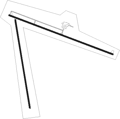
Paris - Bear Lake County
Airport details
| Country | United States of America |
| State | Idaho |
| Region | K1 |
| Airspace | Salt Lake City Ctr |
| Municipality | Bear Lake County |
| Elevation | 5928ft (1807m) |
| Timezone | GMT -7 |
| Coordinates | 42.24975, -111.34164 |
| Magnetic var | |
| Type | land |
| Available since | X-Plane v10.40 |
| ICAO code | 1U7 |
| IATA code | n/a |
| FAA code | n/a |
Communication
| BEAR LAKE COUNTY CTAF/UNICOM | 122.800 |
Nearby Points of Interest:
Grunder Cabin and Outbuildings
-Amos Hulme Barn
-Sam Athay House
-Orson Grimmett Bungalow
-Ezra Allred Cottage
-Dr. George Ashley House
-Bear Lake County Courthouse
-Bear Lake Stake Tabernacle
-Browning Block
-Fred Price Bungalow
-J.R. Shepherd House
-LDS Stake Office Building
-Taft Budge Bungalow
-Alfred Budge House
-Ezra Allred Bungalow
-Wallentine Farmstead
-Paris Cemetery
-Montepelier Odd Fellows Hall
-William and Nora Ream House
-Montpelier Historic District
-John A. Bagley House
-Anna Nielsen Scofield House
-Tony Grove Ranger Station Historic District
-Franklin City Hall
-Franklin Historic Properties
Nearby beacons
| code | identifier | dist | bearing | frequency |
|---|---|---|---|---|
| LHO | BRIGHAM CITY (LOGAN) VOR/DME | 40.5 | 236° | 112.90 |
| EVW | EVANSTON VOR/DME | 60.1 | 163° | 109.60 |
| FBR | FORT BRIDGER VOR/DME | 66.5 | 134° | 114.45 |
Instrument approach procedures
| runway | airway (heading) | route (dist, bearing) |
|---|---|---|
| RW10 | LUNDI (130°) | LUNDI LEANT (17mi, 134°) 11300ft |
| RW10 | MLD (87°) | MLD LEANT (40mi, 72°) 11700ft LEANT (turn) 11300ft |
| RNAV | LEANT 11300ft KOSCH (6mi, 126°) 10300ft HAXEN (2mi, 126°) 9600ft JUVON (5mi, 127°) 7680ft ISELE (3mi, 127°) 6540ft GLUTS (turn) 6150ft (6344mi, 111°) 6340ft FIROS (6350mi, 291°) 11000ft FIROS (turn) | |
| RW28 | BPI (255°) | BPI DHOWS (35mi, 245°) 11900ft CANEN (14mi, 244°) 10900ft |
| RW28 | GEGME (299°) | GEGME CANEN (20mi, 307°) 10900ft |
| RW28 | MLD (87°) | MLD ERRED (45mi, 92°) 11700ft CANEN (18mi, 93°) 10900ft CANEN (turn) 10900ft |
| RNAV | CANEN 10900ft ANUTE (8mi, 289°) 8500ft BOMPS (3mi, 289°) 7300ft 1U7 (4mi, 287°) 5984ft (6344mi, 111°) 6560ft FIROS (6350mi, 291°) 11000ft FIROS (turn) |
Disclaimer
The information on this website is not for real aviation. Use this data with the X-Plane flight simulator only! Data taken with kind consent from X-Plane 12 source code and data files. Content is subject to change without notice.

