Stuart - Micro
Airport details
| Country | United States of America |
| State | Virginia |
| Region | K6 |
| Airspace | Atlanta Ctr |
| Municipality | Patrick County |
| Elevation | 2950ft (899m) |
| Timezone | GMT -5 |
| Coordinates | 36.73613, -80.44541 |
| Magnetic var | |
| Type | land |
| Available since | X-Plane v10.40 |
| ICAO code | 1VA1 |
| IATA code | n/a |
| FAA code | 1VA1 |
Communication
Nearby Points of Interest:
Mayberry Presbyterian Church
-Point Pleasant School
-Barnard Farm
-West Fork Furnace
-Willis Presbyterian Church and Cemetery
-Snake Creek Farm Historic District
-Buena Vista Downtown Historic District
-Patrick County Courthouse
-Stuart Uptown Historic District
-Laurel Hill Farm
-Glenanna
-Floyd Presbyterian Church
-Floyd Historic District
-Sidna Allen House
-Phlegar Farm
-Carter Hydraulic Rams
-Carroll County Courthouse
-Hillsville Historic District
-Goblintown Mill
-R. W. George Mill
-Reynolds Homestead
-Renfro Mill
-Fairy Stone State Park
-Spring Valley Rural Historic District
-Snowville Christian Church
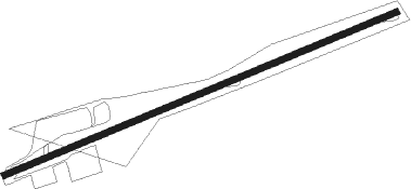
Runway info
| Runway 8 / 26 | ||
| length | 1523m (4997ft) | |
| bearing | 75° / 255° | |
| width | 21m (69ft) | |
| surface | asphalt | |
Nearby beacons
| code | identifier | dist | bearing | frequency |
|---|---|---|---|---|
| PSK | PULASKI (DUBLIN) VORTAC | 24.7 | 323° | 116.80 |
| UV | BALES (MARTINSVILLE) NDB | 26.9 | 105° | 396 |
| TEC | TECH (BLACKSBURG) NDB | 28.4 | 5° | 368 |
| VIT | VINTON (ROANOKE) NDB | 39 | 50° | 277 |
| SIF | SLAMMER (REIDSVILLE) NDB | 39.2 | 117° | 423 |
| ROA | ROANOKE VOR/DME | 40.6 | 32° | 109.40 |
| ODR | WOODRUM (ROANOKE) VOR | 41.8 | 38° | 114.90 |
| IN | REENO (WINSTON SALEM) NDB | 42.1 | 157° | 317 |
| JUH | ASHEE (JEFFERSON) NDB | 45.9 | 251° | 410 |
| GSO | GREENSBORO VORTAC | 47.2 | 146° | 116.20 |
| BLF | BLUEFIELD VOR/DME | 49.6 | 307° | 110 |
| HB | ALAMM NDB | 61.6 | 131° | 361 |
| BZM | BARRETTS MOUNTAIN (HICKOR VOR/DME | 64.7 | 223° | 113.75 |
| LIB | LIBERTY VORTAC | 68.6 | 138° | 113 |
| HK | TAWBA (HICKORY) NDB | 70.6 | 222° | 332 |
Instrument approach procedures
| runway | airway (heading) | route (dist, bearing) |
|---|---|---|
| RW26 | HENBY (272°) | HENBY ZONAB (11mi, 288°) 5100ft |
| RW26 | WILIZ (145°) | WILIZ ZONAB (15mi, 106°) 5800ft ZONAB (turn) 5100ft |
| RNAV | ZONAB 5100ft SIPNY (5mi, 255°) 4500ft FIVRO (2mi, 255°) 3920ft 1VA1 (3mi, 255°) 2967ft (4946mi, 115°) 3364ft UFOVA (4951mi, 295°) 5000ft UFOVA (turn) |
Disclaimer
The information on this website is not for real aviation. Use this data with the X-Plane flight simulator only! Data taken with kind consent from X-Plane 12 source code and data files. Content is subject to change without notice.