Troy - Waco Field
Airport details
| Country | United States of America |
| State | Ohio |
| Region | |
| Airspace | Indianapolis Ctr |
| Municipality | Troy |
| Elevation | 817ft (249m) |
| Timezone | GMT -5 |
| Coordinates | 40.01440, -84.19915 |
| Magnetic var | |
| Type | land |
| Available since | X-Plane v10.40 |
| ICAO code | 1WF |
| IATA code | n/a |
| FAA code | 1WF |
Communication
Nearby Points of Interest:
Overfield Tavern
-Troy Public Square
-Miami County Courthouse
-John Minor Dye Stone House
-Old Piqua High School
-Arrowston
-William Baumgardner Farm
-Aullwood House and Garden
-Arnold Homestead
-Ausenbaugh-McElhenny House
-Lockington Covered Bridge
-Lockington Locks
-Monitor House
-Shawen Acres
-Mercer Log House
-Huffman Prairie
-Fairborn Twin Cinemas
-Dayton Fire Station No. 14
-Kenilworth Avenue Historic District
-Wright-Patterson Air Force Base Mound
-Wilson-Lenox House
-Dayton Masonic Center
-Dayton Memorial Hall
-Landing Apartments
-Engineers Club of Dayton
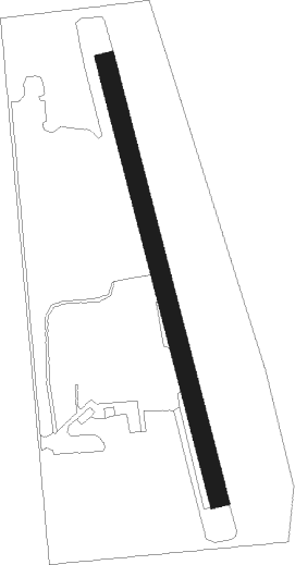
Runway info
| Runway 18 / 36 | ||
| length | 723m (2372ft) | |
| bearing | 167° / 347° | |
| width | 30m (100ft) | |
| surface | grass | |
Nearby beacons
| code | identifier | dist | bearing | frequency |
|---|---|---|---|---|
| DQN | DAYTON VOR/DME | 9 | 271° | 114.50 |
| AT | BRUNY (DAYTON) NDB | 11.8 | 219° | 315 |
| FFO | PATTERSON (DAYTON) TACAN | 13.4 | 144° | 115.20 |
| ROD | ROSEWOOD VORTAC | 17.9 | 30° | 117.50 |
| SGH | DME | 19.4 | 117° | 113.20 |
| XSF | SPRINGFIELD TACAN | 19.6 | 116° | 133.80 |
| MW | ONIDA (MIDDLETOWN) NDB | 26.8 | 196° | 223 |
| HKF | HOOK FIELD (MIDDLETOWN) NDB | 33 | 206° | 239 |
| RID | RICHMOND VOR/DME | 33.3 | 248° | 110.60 |
| AWW | WINCHESTER NDB | 34.4 | 282° | 212 |
| IL | AIRBO (WILMINGTON) NDB | 37.8 | 139° | 407 |
| MXQ | MIDWEST (WILMINGTON) VOR/DME | 39.6 | 146° | 112.90 |
| HW | CUBLA (WILMINGTON) NDB | 42.4 | 154° | 299 |
| CSS | COURT HOUSE (WASHINGTON) NDB | 44.7 | 117° | 414 |
| SQ | PNTHR (CONNERSVILLE) NDB | 45.1 | 256° | 227 |
| BU | BOUTN (COLUMBUS) NDB | 47.2 | 101° | 230 |
| PWF | SPORTYS (BATAVIA) NDB | 56.3 | 181° | 245 |
| FBC | FLAG CITY VORTAC | 60 | 25° | 108.20 |
| CVG | CINCINNATI VORTAC | 64.3 | 207° | 117.30 |
| FWA | FORT WAYNE VORTAC | 73.4 | 314° | 117.80 |
Disclaimer
The information on this website is not for real aviation. Use this data with the X-Plane flight simulator only! Data taken with kind consent from X-Plane 12 source code and data files. Content is subject to change without notice.