Pontotoc - Pontotoc County
Airport details
| Country | United States of America |
| State | Mississippi |
| Region | K7 |
| Airspace | Memphis Ctr |
| Municipality | Pontotoc County |
| Elevation | 438ft (134m) |
| Timezone | GMT -6 |
| Coordinates | 34.27555, -89.03802 |
| Magnetic var | |
| Type | land |
| Available since | X-Plane v10.40 |
| ICAO code | 22M |
| IATA code | n/a |
| FAA code | 22M |
Communication
| Pontotoc County CTAF/UNICOM | 122.800 |
Nearby Points of Interest:
North Broadway Historic District
-George Wright Young House
-Tombigbee State Park
-Houston Carnegie Library
-Judge Bates House
-Bynum Mound and Village Site
-Oxford Courthouse Square Historic District
-Lafayette County Courthouse
-Barnard Observatory
-Ripley Historic District
-Old U.S. Post Office
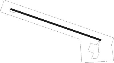
Runway info
| Runway 11 / 29 | ||
| length | 915m (3002ft) | |
| bearing | 110° / 290° | |
| width | 15m (50ft) | |
| surface | asphalt | |
Nearby beacons
| code | identifier | dist | bearing | frequency |
|---|---|---|---|---|
| OTB | TUPELO VOR/DME | 12.3 | 102° | 109.80 |
| TU | VERON (TUPELO) NDB | 14.5 | 109° | 420 |
| UV | TUNNG (OXFORD) NDB | 29.8 | 281° | 426 |
| HLI | HOLLY SPRINGS VORTAC | 37.3 | 317° | 112.40 |
| CBM | CALEDONIA (COLUMBUS) VORTAC | 48.3 | 137° | 115.20 |
| UU | SEYER (CORINTH) NDB | 49 | 30° | 334 |
| IGB | BIGBEE (COLUMBUS) VORTAC | 54.1 | 146° | 116.20 |
| MEM | MEMPHIS VORTAC | 64.4 | 308° | 117.50 |
Disclaimer
The information on this website is not for real aviation. Use this data with the X-Plane flight simulator only! Data taken with kind consent from X-Plane 12 source code and data files. Content is subject to change without notice.