Noblesville
Airport details
| Country | United States of America |
| State | Indiana |
| Region | |
| Airspace | Indianapolis Ctr |
| Municipality | Noblesville |
| Elevation | 830ft (253m) |
| Timezone | GMT -5 |
| Coordinates | 40.00358, -85.96465 |
| Magnetic var | |
| Type | land |
| Available since | X-Plane v10.40 |
| ICAO code | 23II |
| IATA code | n/a |
| FAA code | I80 |
Communication
| Noblesville CTAF | 122.900 |
| Noblesville INDIANAPOLIS ApproachROACH | 124.650 |
| Noblesville INDIANAPOLIS DepartureARTURE | 124.650 |
Nearby Points of Interest:
Conner Street Historic District
-South 9th Street Historic District
-Noblesville Milling Company Mill
-William Houston Craig House
-Daniel Craycraft House
-Judge Earl S. Stone House
-Noblesville Commercial Historic District
-Hamilton County Courthouse
-Robert L. Wilson House
-Catherine Street Historic District
-Dr. Samuel Harrell House
-Nickel Plate Road 587
-Holliday Hydroelectric Powerhouse and Dam
-West-Harris House
-Browne-Rafert House
-John Kinzer House
-Oaklandon Historic District
-Union High Academy Historic District
-Christopher Apple House
-Thornhurst Addition
-Marion County Bridge 0501F
-Frank Littleton Round Barn
-Fort Benjamin Harrison
-Hillcrest Country Club
-Camp Edwin F. Glenn
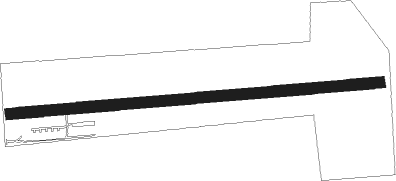
Runway info
| Runway 09 / 27 | ||
| length | 1037m (3402ft) | |
| bearing | 90° / 270° | |
| width | 30m (100ft) | |
| surface | grass | |
| displ threshold | 122m (400ft) / 0m (0ft) | |
Nearby beacons
| code | identifier | dist | bearing | frequency |
|---|---|---|---|---|
| UMP | METROPOLITAN (INDIANAPOLIS) NDB | 5.5 | 232° | 338 |
| FV | LAREZ (INDIANAPOLIS) NDB | 16.8 | 227° | 349 |
| AI | VIDEO (ANDERSON) NDB | 21.2 | 82° | 394 |
| VHP | BRICKYARD VORTAC | 21.7 | 245° | 116.30 |
| CO | COLFA (INDIANAPOLIS) NDB | 23.1 | 213° | 232 |
| SHB | SHELBYVILLE VOR/DME | 23.2 | 159° | 112 |
| MIE | MUNCIE VOR/DME | 29.7 | 68° | 114.40 |
| UWL | NEW CASTLE NDB | 30.6 | 101° | 385 |
| JN | BALLL (MUNCIE) NDB | 31.4 | 75° | 365 |
| MI | BALLL (MUNCIE) NDB | 31.4 | 75° | 365 |
| OKK | KOKOMO VORTAC | 31.7 | 350° | 113.50 |
| MZZ | MARION VOR/DME | 32.1 | 30° | 108.60 |
| GUS | GRISSOM (PERU) VORTAC | 39.4 | 344° | 108.45 |
| SQ | PNTHR (CONNERSVILLE) NDB | 40.7 | 105° | 227 |
| BA | CLIFS (COLUMBUS) NDB | 41.4 | 168° | 410 |
| CFJ | CRAWFORDSVILLE NDB | 43.7 | 269° | 388 |
| HLB | BATESVILLE NDB | 51.2 | 133° | 254 |
| OOM | HOOSIER (BLOOMINGTON) VORTAC | 59.7 | 217° | 110.20 |
| FWA | FORT WAYNE VORTAC | 68.4 | 39° | 117.80 |
Disclaimer
The information on this website is not for real aviation. Use this data with the X-Plane flight simulator only! Data taken with kind consent from X-Plane 12 source code and data files. Content is subject to change without notice.