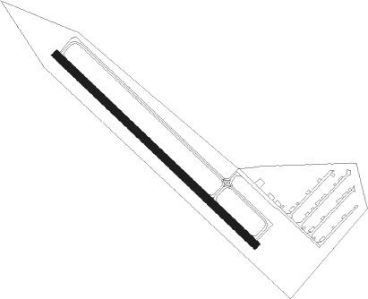
Forest Lake
Airport details
| Country | United States of America |
| State | Minnesota |
| Region | K3 |
| Airspace | Minneapolis Ctr |
| Municipality | Forest Lake |
| Elevation | 923ft (281m) |
| Timezone | GMT -6 |
| Coordinates | 45.24856, -92.99431 |
| Magnetic var | |
| Type | land |
| Available since | X-Plane v10.40 |
| ICAO code | 25D |
| IATA code | n/a |
| FAA code | 25D |
Communication
| Forest Lake CTAF/UNICOM | 122.700 |
Nearby Points of Interest:
Moody Barn
-Carlos Avery Game Farm
-Johannes Erickson House
-Hay Lake School
-E. H. Hobe House-Solheim
-Crescent Grange Hall No. 512
-Swedish Evangelical Lutheran Church
-Charles P. Noyes Cottage
-First National Bank of White Bear
-John Copas House
-Marine on St. Croix
-Cyrus B. Cobb House
-Marine Mill
-James J. Hill's North Oaks Farm, Dairy Building
-Croixsyde
-Center City Historic District
-Arcola Mills
-Pest House
-Cedar Creek Ecosystem Science Reserve
-First Baptist Church
-St. Croix Boom Company House and Barn
-St. Croix Boom Site
-Gateway State Trail
-Warden's House Museum
-Minnesota Territorial Prison
Runway info
| Runway 13 / 31 | ||
| length | 823m (2700ft) | |
| bearing | 128° / 308° | |
| width | 23m (75ft) | |
| surface | asphalt | |
Nearby beacons
| code | identifier | dist | bearing | frequency |
|---|---|---|---|---|
| GEP | GOPHER (MINNEAPOLIS) VORTAC | 17.1 | 255° | 117.30 |
| MSP | MINNEAPOLIS VOR/DME | 23.5 | 215° | 115.30 |
| ROS | RUSH CITY NDB | 26.8 | 5° | 282 |
| FCM | FLYING CLOUD (MINNEAPOLIS VOR/DME | 31.7 | 227° | 117.70 |
| PNM | PRINCETON NDB | 32 | 297° | 368 |
| FGT | FARMINGTON VORTAC | 37.9 | 197° | 115.70 |
| RG | REGUE (RED WING) NDB | 41.7 | 152° | 274 |
| RZN | DME | 43.1 | 47° | 109.40 |
| BXR | BIG DOCTOR (SIREN) NDB | 43.3 | 48° | 203 |
| ST | HUSSK (ST CLOUD) NDB | 43.3 | 283° | 342 |
Disclaimer
The information on this website is not for real aviation. Use this data with the X-Plane flight simulator only! Data taken with kind consent from X-Plane 12 source code and data files. Content is subject to change without notice.
