Baytown - Ferris
Airport details
| Country | United States of America |
| State | Texas |
| Region | |
| Airspace | Houston Oceanic Ctr |
| Municipality | Harris County |
| Elevation | 35ft (11m) |
| Timezone | GMT -6 |
| Coordinates | 29.83670, -94.96948 |
| Magnetic var | |
| Type | land |
| Available since | X-Plane v10.40 |
| ICAO code | 25TA |
| IATA code | n/a |
| FAA code | 25TA |
Communication
Nearby Points of Interest:
San Jacinto Battleground State Historic Site
-Washburn Tunnel
-Lunar and Planetary Institute
-Christopher C. Kraft Jr. Mission Control Center
-McKee Street Bridge
-James Bute Company Warehouse
-National Biscuit Company Building
-San Jacinto Street Bridge over Buffalo Bayou
-Arthur B. Cohn House
-1910 Harris County Courthouse
-Merchants and Manufacturers Building
-Pillot Building
-Houston Cotton Exchange Building
-W. L. Foley Building
-Scanlan Building
-Main Street/Market Square Historic District
-United States Customhouse
-Houston Post-Dispatch Building
-Hogg Building
-S. H. Kress and Co. Building
-JPMorgan Chase Building
-Stowers Building
-City National Bank Building
-Antioch Missionary Baptist Church
-Houston Negro Hospital School of Nursing Building
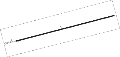
Runway info
| Runway 8 / 26 | ||
| length | 1404m (4606ft) | |
| bearing | 81° / 261° | |
| width | 12m (40ft) | |
| surface | concrete | |
Nearby beacons
| code | identifier | dist | bearing | frequency |
|---|---|---|---|---|
| BVP | NIXIN (HOUSTON) NDB | 15.8 | 303° | 326 |
| EFD | ELLINGTON (HOUSTON) TACAN | 17 | 219° | 109.40 |
| IAH | HUMBLE (HOUSTON) VORTAC | 20.8 | 288° | 116.60 |
| MHF | TRINITY (SMITH POINT) VOR/DME | 20.9 | 143° | 113.60 |
| DAS | DAISETTA VORTAC | 27 | 43° | 116.90 |
| VUH | SCHOLES (GALVESTON) VOR/DME | 34.4 | 170° | 113 |
| GDE | GOODHUE (BEAUMONT) NDB | 41.8 | 73° | 368 |
| CX | ALIBI (HOUSTON) NDB | 44.4 | 320° | 281 |
| SBI | SABINE PASS VOR/DME | 49.3 | 99° | 115.40 |
| BPT | BEAUMONT VOR/DME | 50 | 83° | 114.50 |
| UTS | HUNTSVILLE NDB | 63.1 | 325° | 308 |
Disclaimer
The information on this website is not for real aviation. Use this data with the X-Plane flight simulator only! Data taken with kind consent from X-Plane 12 source code and data files. Content is subject to change without notice.