Hanson - Cranland
Airport details
| Country | United States of America |
| State | Massachusetts |
| Region | |
| Airspace | Boston Ctr |
| Municipality | Hanson |
| Elevation | 68ft (21m) |
| Timezone | GMT -5 |
| Coordinates | 42.02749, -70.83898 |
| Magnetic var | |
| Type | land |
| Available since | X-Plane v10.30 |
| ICAO code | 28M |
| IATA code | n/a |
| FAA code | 28M |
Communication
Nearby Points of Interest:
District 7 School
-Tarkiln School
-Plympton Village Historic District
-Whitman Park
-Pembroke Friends Meetinghouse
-Sachem Rock Farm
-Kingston Center Historic District
-Island Grove Park National Register District
-Frederic C. Adams Public Library
-Commonwealth Shoe and Leather Co.
-Stetson House
-Hanover Center Historic District
-Bradford House
-The Tack Factory
-Stetson-Ford House
-Rockland Almshouse
-Hatch Homestead and Mill Historic District
-Old Town Hall Historic District
-William H. McElwain School
-Capt. Gamaliel Bradford House
-Capt. Gershom Bradford House
-Captain Daniel Bradford House
-Lower Union Street Historic District
-John and Priscilla Alden Family Sites
-Grand Army of the Republic Hall
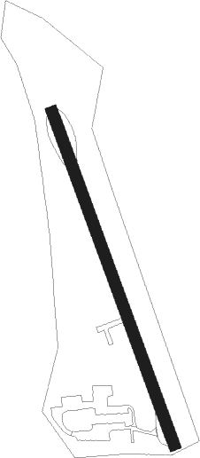
Runway info
| Runway 18 / 36 | ||
| length | 557m (1827ft) | |
| bearing | 159° / 339° | |
| width | 18m (60ft) | |
| surface | asphalt | |
Nearby beacons
| code | identifier | dist | bearing | frequency |
|---|---|---|---|---|
| OW | STOGE (NORWOOD) NDB | 14 | 288° | 397 |
| BOS | BOSTON VOR/DME | 20.9 | 335° | 112.70 |
| FMH | OTIS (FALMOUTH) TACAN | 26.4 | 139° | 115.80 |
| PVC | PROVINCETOWN NDB | 27.5 | 86° | 389 |
| PVD | PROVIDENCE VOR/DME | 32 | 243° | 115.60 |
| HY | BOGEY (HYANNIS) NDB | 34 | 116° | 342 |
| LFV | MARCONI (NORTH TRURO) VOR/DME | 35.7 | 91° | 114.70 |
| MVY | MARTHA'S VINEYARD VOR/DME | 39.2 | 160° | 114.50 |
| CQX | NAUSET (CHATHAM) NDB | 43 | 112° | 279 |
| LWM | DME | 44.2 | 340° | 112.50 |
| MHT | MANCHESTER VOR/DME | 55.7 | 328° | 114.40 |
| ACK | NANTUCKET VOR/DME | 57.7 | 133° | 116.20 |
| MJ | FITZY (MANCHESTER) NDB | 58.8 | 320° | 209 |
| SEY | SANDY POINT (BLOCK ISLAND VOR/DME | 61.3 | 221° | 117.80 |
Disclaimer
The information on this website is not for real aviation. Use this data with the X-Plane flight simulator only! Data taken with kind consent from X-Plane 12 source code and data files. Content is subject to change without notice.