Vernon - Lehman
Airport details
| Country | United States of America |
| State | Texas |
| Region | |
| Airspace | Ft Worth Ctr |
| Municipality | Wilbarger County |
| Elevation | 1273ft (388m) |
| Timezone | GMT -6 |
| Coordinates | 34.08735, -99.45529 |
| Magnetic var | |
| Type | land |
| Available since | X-Plane v10.40 |
| ICAO code | 28TX |
| IATA code | n/a |
| FAA code | 28TX |
Communication
Nearby Points of Interest:
Doan's Adobe House
-Tillman County Courthouse
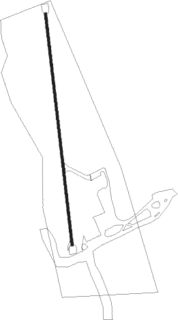
Runway info
| Runway 18 / 36 | ||
| length | 565m (1854ft) | |
| bearing | 178° / 358° | |
| width | 6m (20ft) | |
| surface | asphalt | |
Nearby beacons
| code | identifier | dist | bearing | frequency |
|---|---|---|---|---|
| LTS | ALTUS VORTAC | 35.7 | 18° | 109.80 |
| SPS | WICHITA FALLS VORTAC | 43.3 | 97° | 112.70 |
| CDS | CHILDRESS VORTAC | 44.7 | 289° | 117 |
| GTH | DME | 47.6 | 251° | 114.50 |
| SHP | SHEPPARD (WICHITA FALLS) TACAN | 48.5 | 96° | 110.80 |
| HBR | HOBART VORTAC | 50.6 | 27° | 111.80 |
| SKB | SCOTLAND (WICHITA FALLS) NDB | 51.5 | 108° | 344 |
| GHX | GRAHAM NDB | 73.2 | 134° | 371 |
Disclaimer
The information on this website is not for real aviation. Use this data with the X-Plane flight simulator only! Data taken with kind consent from X-Plane 12 source code and data files. Content is subject to change without notice.