Gardiner
Airport details
| Country | United States of America |
| State | Montana |
| Region | K1 |
| Airspace | Salt Lake City Ctr |
| Municipality | Gardiner |
| Elevation | 5286ft (1611m) |
| Timezone | GMT -7 |
| Coordinates | 45.04993, -110.74660 |
| Magnetic var | |
| Type | land |
| Available since | X-Plane v10.40 |
| ICAO code | 29S |
| IATA code | n/a |
| FAA code | n/a |
Communication
| GARDINER CTAF/UNICOM | 122.800 |
Nearby Points of Interest:
North Entrance Road Historic District
-Mammoth Hot Springs Historic District
-Fort Yellowstone
-H.W. Child House
-OTO Homestead and Dude Ranch
-Obsidian Cliff
-Grand Loop Road Historic District
-Lamar Buffalo Ranch
-Crail Ranch Buildings
-Lonesomehurst Cabin
-Eagle's Store
-West Yellowstone Oregon Shortline Terminus Historic District
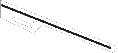
Runway info
| Runway 10 / 28 | ||
| length | 1006m (3301ft) | |
| bearing | 109° / 289° | |
| width | 17m (55ft) | |
| surface | asphalt | |
Nearby beacons
| code | identifier | dist | bearing | frequency |
|---|---|---|---|---|
| WYS | YELLOWSTONE DME | 27.7 | 226° | 114.85 |
| LO | TARGY (WEST YELLOWSTONE) NDB | 34.3 | 224° | 415 |
| EKS | ENNIS NDB | 40.5 | 284° | 286 |
| LVM | LIVINGSTON VOR/DME | 41.2 | 25° | 116.10 |
| BZN | BOZEMAN VOR/DME | 47.3 | 331° | 112.40 |
| BZ | MANNI (BOZEMAN) NDB | 54.3 | 327° | 266 |
Disclaimer
The information on this website is not for real aviation. Use this data with the X-Plane flight simulator only! Data taken with kind consent from X-Plane 12 source code and data files. Content is subject to change without notice.