Jamestown - Jamestown Muni
Airport details
| Country | United States of America |
| State | Tennessee |
| Region | K7 |
| Airspace | Indianapolis Ctr |
| Municipality | Fentress County |
| Elevation | 1691ft (515m) |
| Timezone | GMT -6 |
| Coordinates | 36.34969, -84.94664 |
| Magnetic var | |
| Type | land |
| Available since | X-Plane v10.40 |
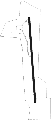
| ICAO code | 2A1 |
| IATA code | n/a |
| FAA code | 2A1 |
Communication
| Jamestown Muni CTAF/UNICOM | 122.800 |
Nearby Points of Interest:
Forbus
-Alpine Institute
-Pickett State Rustic Park Historic District
-Black Creek Fire Lookout Tower
-Barton Chapel
-Cumberland County Courthouse
-Pioneer Hall
-White Plains
-Cumberland Homesteads
-Old Wayne County High School
-Fairchild House
-The Arcade
-Cookeville Railroad Depot
-Clay County Courthouse
-Broad Street Church of Christ
-Stearns Administrative and Commercial District
-American Temperance University
-Cornstalk Heights
Nearby beacons
| code | identifier | dist | bearing | frequency |
|---|---|---|---|---|
| LVT | LIVINGSTON VOR/DME | 17.6 | 317° | 108.40 |
| SCX | SCOTT (ONEIDA) NDB | 18.4 | 73° | 403 |
| HCH | HINCH MTN (CROSSVILLE) VOR/DME | 34.1 | 183° | 117.60 |
| HEM | HUCHN NDB | 37.8 | 241° | 233 |
| CDX | CUMBERLAND RIVER (SOMERSET) NDB | 40.8 | 22° | 388 |
| DTE | MARK ANTON (DAYTON) NDB | 52.1 | 179° | 394 |
| LOZ | LONDON VOR/DME | 57.5 | 51° | 116.55 |
Instrument approach procedures
| runway | airway (heading) | route (dist, bearing) |
|---|---|---|
| RWNVB | ZILIB (0°) | ZILIB 4400ft |
| RNAV | ZILIB 4400ft JAGGY (7mi, 0°) 3500ft 2A1 (5mi, 0°) 1728ft (5161mi, 113°) 2094ft ZOLPU (5161mi, 293°) 4000ft ZOLPU (turn) | |
| RWNVC | ZOLPU (180°) | ZOLPU 4000ft |
| RNAV | ZOLPU 4000ft NOVEE (7mi, 180°) 3500ft JUBUN (2mi, 180°) 2600ft 2A1 (3mi, 180°) 1744ft (5161mi, 113°) 2094ft ZILIB (5160mi, 293°) 4400ft ZILIB (turn) |
Disclaimer
The information on this website is not for real aviation. Use this data with the X-Plane flight simulator only! Data taken with kind consent from X-Plane 12 source code and data files. Content is subject to change without notice.