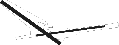
Newburyport - Plum Island
Airport details
| Country | United States of America |
| State | Massachusetts |
| Region | |
| Airspace | Boston Ctr |
| Municipality | Newbury |
| Elevation | 11ft (3m) |
| Timezone | GMT -5 |
| Coordinates | 42.79524, -70.84341 |
| Magnetic var | |
| Type | land |
| Available since | X-Plane v10.40 |
| ICAO code | 2B2 |
| IATA code | n/a |
| FAA code | 2B2 |
Communication
Nearby Points of Interest:
Newbury Historic District
-James Noyes House
-Superior Courthouse and Bartlett Mall
-Benjamin Coker House
-Market Square Historic District
-Brown Square House
-Newburyport Historic District
-Dodge Building
-Hale-Boynton House
-Rocky Hill Meeting House
-Abraham Adams House
-Platts-Bradstreet House
-Macy-Colby House
-Rev. John Tufts House
-Thomas Lambert House
-John Greenleaf Whittier House
-Amesbury Friends Meeting House
-Timothy Morse House
-Chaplin-Clarke House
-Ross Tavern
-Dickinson-Pillsbury-Witham House
-Samuel March House
-Brown's Manor
-Soldiers and Sailors Memorial Building
-High Street Historic District (Ipswich, Massachusetts)
Nearby beacons
| code | identifier | dist | bearing | frequency |
|---|---|---|---|---|
| LWM | DME | 11.5 | 258° | 112.50 |
| PSM | (PORTSMOUTH) DME | 17.3 | 2° | 116.50 |
| MHT | MANCHESTER VOR/DME | 23.5 | 278° | 114.40 |
| ESG | ROLLINS (ROLLINSFORD) NDB | 25.5 | 2° | 260 |
| BOS | BOSTON VOR/DME | 27 | 198° | 112.70 |
| MJ | FITZY (MANCHESTER) NDB | 30.4 | 276° | 209 |
| SF | SANFD (SANFORD) NDB | 32.3 | 1° | 349 |
| CO | EPSOM (CONCORD) NDB | 33 | 298° | 216 |
| ENE | KENNEBUNK VOR/DME | 39.1 | 20° | 117.10 |
| CON | CONCORD VOR/DME | 41 | 300° | 112.90 |
| OW | STOGE (NORWOOD) NDB | 42.4 | 203° | 397 |
| PVC | PROVINCETOWN NDB | 51.5 | 140° | 389 |
| LC | BLNAP (LACONIA) NDB | 53.9 | 317° | 328 |
| LFV | MARCONI (NORTH TRURO) VOR/DME | 58.8 | 134° | 114.70 |
Disclaimer
The information on this website is not for real aviation. Use this data with the X-Plane flight simulator only! Data taken with kind consent from X-Plane 12 source code and data files. Content is subject to change without notice.

