Sunray - Cluck Ranch
Airport details
| Country | United States of America |
| State | Texas |
| Region | |
| Airspace | Albuquerque Ctr |
| Municipality | Sherman County |
| Elevation | 3420ft (1042m) |
| Timezone | GMT -6 |
| Coordinates | 36.17267, -101.69666 |
| Magnetic var | |
| Type | land |
| Available since | X-Plane v10.40 |
| ICAO code | 2E3 |
| IATA code | n/a |
| FAA code | n/a |
Communication
| Cluck Ranch CTAF | 122.900 |
| Cluck Ranch ALBUQUERQUE CNTR | 127.850 |
Nearby Points of Interest:
Texas County Courthouse
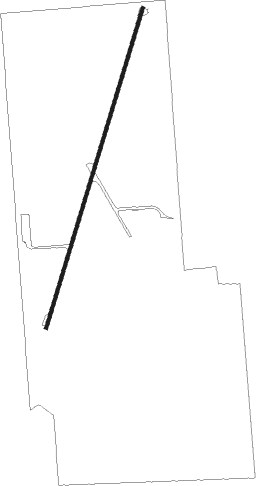
Runway info
| Runway 1 / 19 | ||
| length | 1100m (3609ft) | |
| bearing | 26° / 206° | |
| width | 11m (35ft) | |
| surface | asphalt | |
| blast zone | 0m (0ft) / 7m (23ft) | |
Nearby beacons
| code | identifier | dist | bearing | frequency |
|---|---|---|---|---|
| BGD | BORGER VORTAC | 26.7 | 139° | 108.60 |
| GUY | GUYMON NDB | 33.3 | 20° | 275 |
| DHT | DALHART VORTAC | 41.4 | 265° | 112 |
| PYX | PERRYTON NDB | 48.1 | 76° | 266 |
| PNH | PANHANDLE VORTAC | 56.3 | 180° | 116.60 |
| LB | PANCK (LIBERAL) NDB | 59.4 | 43° | 383 |
| HQG | HUGOTON NDB | 61.5 | 18° | 365 |
| LBL | LIBERAL VORTAC | 62.9 | 40° | 112.30 |
Disclaimer
The information on this website is not for real aviation. Use this data with the X-Plane flight simulator only! Data taken with kind consent from X-Plane 12 source code and data files. Content is subject to change without notice.