Fordsville - Rough River
Airport details
| Country | United States of America |
| State | Kentucky |
| Region | K5 |
| Airspace | Indianapolis Ctr |
| Municipality | Grayson County |
| Elevation | 577ft (176m) |
| Timezone | GMT -6 |
| Coordinates | 37.60981, -86.50716 |
| Magnetic var | |
| Type | land |
| Available since | X-Plane v10.40 |
| ICAO code | 2I3 |
| IATA code | n/a |
| FAA code | n/a |
Communication
| Rough River CTAF/UNICOM | 122.800 |
Nearby Points of Interest:
Falls of Rough Historic District
-Louisville, Henderson, and St. Louis Railroad Depot
-Hunter House
-Jack Thomas House
-Dundee Masonic Lodge No. 733
-Bill Monroe Farm
-Old Perry County Courthouse
-Samuel E. Hill House
-Pendleton House
-Immaculate Conception Church
-Old Town Historic District
-Cannelton Cotton Mill
-Annis Mound and Village Site
-Robert C. Beauchamp House
-Tell City Oddfellows' Hall
-Nester House
-Rockhouse Cliffs Rockshelters
-Reed-Dossey House
-Young's Ferry House
-Brandenburg Methodist Episcopal Church
-Brandenburg Commercial District
-Meade County Jail
-Haphazard (Owensboro, Kentucky)
-Yewell House
-St. Joseph's Catholic Church
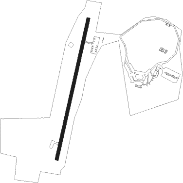
Runway info
| Runway 2 / 20 | ||
| length | 977m (3205ft) | |
| bearing | 21° / 201° | |
| width | 23m (75ft) | |
| surface | asphalt | |
Nearby beacons
| code | identifier | dist | bearing | frequency |
|---|---|---|---|---|
| MYS | MYSTIC VOR | 21.1 | 43° | 108.20 |
| FTK | FORT KNOX VOR/DME | 31 | 61° | 109.60 |
| OWB | OWENSBORO VOR/DME | 32.3 | 281° | 108.60 |
| CCT | CITY DME | 38.5 | 253° | 109.80 |
| EWO | NEW HOPE VOR/DME | 39.5 | 88° | 110.80 |
| BWG | GREEN DME | 41 | 175° | 117.90 |
| BW | NOORA (BOWLING GREEN) NDB | 43.8 | 178° | 236 |
| LK | LAANG (LOUISVILLE) NDB | 52.4 | 59° | 414 |
| IIU | LOUISVILLE VORTAC | 53.1 | 62° | 114.80 |
| EVV | VICCI (EVANSVILLE) NDB | 54 | 299° | 219 |
| BQM | (LOUISVILLE) DME | 54.6 | 54° | 112.20 |
| JV | CATCH (JEFFERSONVILLE) NDB | 63.4 | 42° | 331 |
| FK | AIRBE(FT CAMPBELL/HOPKINSVILLE NDB | 68 | 226° | 273 |
| CKV | CLARKSVILLE VOR/DME | 73.4 | 223° | 110.60 |
Disclaimer
The information on this website is not for real aviation. Use this data with the X-Plane flight simulator only! Data taken with kind consent from X-Plane 12 source code and data files. Content is subject to change without notice.