Louisville - Louisville Muni
Airport details
| Country | United States of America |
| State | Georgia |
| Region | K7 |
| Airspace | Atlanta Ctr |
| Municipality | Louisville |
| Elevation | 328ft (100m) |
| Timezone | GMT -5 |
| Coordinates | 32.98594, -82.38480 |
| Magnetic var | |
| Type | land |
| Available since | X-Plane v10.40 |
| ICAO code | 2J3 |
| IATA code | n/a |
| FAA code | n/a |
Communication
| Louisville Muni CTAF | 122.900 |
Nearby Points of Interest:
Jefferson County Courthouse
-Old Market
-Louisville Commercial Historic District
-Birdsville Plantation
-Glascock County Courthouse
-John James Jones House
-Waynesboro Historic District
-Burke County Courthouse
-Holt Brothers Banking Company Building
-Washington County Courthouse
-Charles Madden House
-Tennille Baptist Church
-Tennille Banking Company Building
-Warthen Historic District
-Camp Lawton
-Johnson County Courthouse
-James Coleman House
-Swainsboro Light and Water Plant
-Bath Presbyterian Church and Cemetery
-Josiah Davis House
-Jenkins County Courthouse
-Downtown Millen Historic District
-Albert Neal Durden House
-John Rountree Log House
-Twin City Historic District
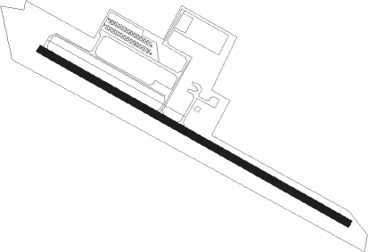
Runway info
| Runway 13 / 31 | ||
| length | 1526m (5007ft) | |
| bearing | 119° / 299° | |
| width | 30m (100ft) | |
| surface | asphalt | |
| blast zone | 31m (102ft) / 29m (95ft) | |
Nearby beacons
| code | identifier | dist | bearing | frequency |
|---|---|---|---|---|
| EEX | EMANUEL COUNTY (SWAINSBORO) NDB | 19.4 | 192° | 309 |
| AG | BUSHE (AUGUSTA) NDB | 28.4 | 56° | 233 |
| DBN | DUBLIN VORTAC | 33.9 | 227° | 113.10 |
| EMR | EMORY (AUGUSTA) NDB | 34.6 | 39° | 385 |
| AA | CEDAR (THOMSON) NDB | 34.8 | 337° | 341 |
| UMB | CULVR (MILLEDGEVILLE) NDB | 40.2 | 282° | 380 |
| DB | CREKE (DUBLIN) NDB | 43.7 | 231° | 251 |
| IRQ | COLLIERS VORTAC | 44.7 | 17° | 113.90 |
| JYL | SYLVANIA NDB | 44.7 | 113° | 245 |
| UQN | ONYUN (VIDALIA) NDB | 45.9 | 173° | 372 |
| BZ | BULLO (STATESBORO) NDB | 50 | 128° | 407 |
| VV | JUNNE (GREENSBORO) NDB | 50.9 | 316° | 353 |
| AIK | AIKEN NDB | 53.4 | 47° | 347 |
| MQW | MC RAE NDB | 59 | 209° | 280 |
| EZM | EASTMAN NDB | 64.4 | 222° | 366 |
| AHN | ATHENS VOR/DME | 74.5 | 316° | 109.60 |
Instrument approach procedures
| runway | airway (heading) | route (dist, bearing) |
|---|---|---|
| RW13 | NOVME (119°) | NOVME 3000ft |
| RNAV | NOVME 3000ft WEMXO (8mi, 119°) 2000ft ZONUD (3mi, 119°) 1200ft 2J3 (3mi, 119°) 373ft (5022mi, 112°) 1000ft NOVME (5034mi, 292°) 3000ft NOVME (turn) | |
| RW31 | IRXEF (299°) | IRXEF 3000ft |
| RNAV | IRXEF 3000ft UTENE (8mi, 299°) 2000ft ZAMEP (3mi, 299°) 1160ft 2J3 (3mi, 299°) 339ft (5022mi, 112°) 1000ft IRXEF (5010mi, 292°) 3000ft IRXEF (turn) |
Disclaimer
The information on this website is not for real aviation. Use this data with the X-Plane flight simulator only! Data taken with kind consent from X-Plane 12 source code and data files. Content is subject to change without notice.