Lawrenceburg - Lawrenceburg-lawrence County
Airport details
| Country | United States of America |
| State | Tennessee |
| Region | K7 |
| Airspace | Memphis Ctr |
| Municipality | Lawrence County |
| Elevation | 936ft (285m) |
| Timezone | GMT -6 |
| Coordinates | 35.23431, -87.25794 |
| Magnetic var | |
| Type | land |
| Available since | X-Plane v10.40 |
| ICAO code | 2M2 |
| IATA code | n/a |
| FAA code | n/a |
Communication
| Lawrenceburg-Lawrence County AWOS 3 | 120.175 |
| Lawrenceburg-Lawrence County CTAF/UNICOM | 122.800 |
Nearby Points of Interest:
Garrett House
-George W. Tillery House
-Campbell Chapel African Methodist Episcopal Church
-Reveille
-Original Church of God
-Wilkinson-Martin House
-Bridgeforth High School
-Austin Hewitt Home
-Milky Way Farm
-Olivet United Methodist Church, Parsonage and School
-Copeland Whitfield House
-Elisha White House
-Lairdland Farm House
-Clifton Place
-Pine Hill
-Webster Farm
-Lewis County Courthouse
-Columbia Arsenal
-Mercer Hall
-Union Station
-Skipwith Hall
-Athenaeum
-Polk Sisters' House
-Joe Chase Adams House
-Governor George Smith Houston House
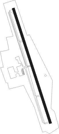
Runway info
| Runway 17 / 35 | ||
| length | 1527m (5010ft) | |
| bearing | 164° / 344° | |
| width | 30m (100ft) | |
| surface | asphalt | |
Nearby beacons
| code | identifier | dist | bearing | frequency |
|---|---|---|---|---|
| MSL | MUSCLE SHOALS VORTAC | 33.6 | 204° | 116.50 |
| GHM | (CENTERVILLE) DME | 37.2 | 342° | 111.60 |
| DCU | DME | 38.5 | 151° | 112.80 |
| RQZ | ROCKET (HUNTSVILLE) VORTAC | 40.3 | 125° | 112.20 |
| SYI | SHELBYVILLE VOR/DME | 44.6 | 68° | 113.55 |
| BNA | NASHVILLE VORTAC | 60.9 | 32° | 114.10 |
| FQW | WALTER HILL (MURFREESBORO) NDB | 61.4 | 51° | 371 |
Instrument approach procedures
| runway | airway (heading) | route (dist, bearing) |
|---|---|---|
| RW17 | WABOL (164°) | WABOL 3700ft |
| RW17 | YUNUR (128°) | YUNUR 3700ft WABOL (8mi, 79°) 3700ft |
| RW17 | ZALPI (203°) | ZALPI 3700ft WABOL (8mi, 259°) 3700ft |
| RNAV | WABOL 3700ft ORAVY (8mi, 164°) 2500ft 2M2 (5mi, 164°) 996ft (5271mi, 112°) 1225ft UWNED (5267mi, 292°) 3800ft UWNED (turn) | |
| RW35 | UWNED (344°) | UWNED 3800ft |
| RW35 | ZIDID (310°) | ZIDID 3800ft UWNED (8mi, 259°) 3800ft |
| RW35 | ZUPNA (21°) | ZUPNA 3800ft UWNED (8mi, 79°) 3800ft |
| RNAV | UWNED 3800ft YITUT (8mi, 344°) 2600ft JOMVU (2mi, 344°) 1800ft 2M2 (3mi, 344°) 987ft (5271mi, 112°) 1293ft WABOL (5274mi, 292°) 3700ft WABOL (turn) |
Disclaimer
The information on this website is not for real aviation. Use this data with the X-Plane flight simulator only! Data taken with kind consent from X-Plane 12 source code and data files. Content is subject to change without notice.