Gordon - Spring Lake
Airport details
| Country | United States of America |
| State | Nebraska |
| Region | |
| Airspace | Denver Ctr |
| Municipality | Sheridan County |
| Elevation | 3813ft (1162m) |
| Timezone | GMT -7 |
| Coordinates | 42.44999, -102.13380 |
| Magnetic var | |
| Type | land |
| Available since | X-Plane v10.40 |
| ICAO code | 2NE4 |
| IATA code | n/a |
| FAA code | 2NE4 |
Communication
Nearby Points of Interest:
Nebraska Sand Hills Mixed Grasslands
-Lee and Gottliebe Fritz House
-Sheridan County Courthouse
-Plains Theatre
-Spade Ranch Store
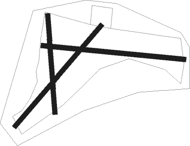
Runway info
Runway 09 / 27  | ||
| length | 546m (1791ft) | |
| bearing | 97° / 277° | |
| width | 18m (60ft) | |
| surface | grass | |
| Runway 05 / 23 | ||
| length | 509m (1670ft) | |
| bearing | 53° / 233° | |
| width | 18m (60ft) | |
| surface | grass | |
| Runway 18 / 36 | ||
| length | 376m (1234ft) | |
| bearing | 180° / 0° | |
| width | 18m (60ft) | |
| surface | grass | |
Nearby beacons
| code | identifier | dist | bearing | frequency |
|---|---|---|---|---|
| GRN | GORDON NDB | 21.1 | 353° | 414 |
| AIA | ALLIANCE VOR/DME | 38 | 240° | 111.80 |
| HIN | WHITNEY (CHADRON) NDB | 48.1 | 292° | 275 |
Disclaimer
The information on this website is not for real aviation. Use this data with the X-Plane flight simulator only! Data taken with kind consent from X-Plane 12 source code and data files. Content is subject to change without notice.