Alpine - Kayutah Lake
Airport details
| Country | United States of America |
| State | New York |
| Region | |
| Airspace | New York Ctr |
| Municipality | Town of Catharine |
| Elevation | 1383ft (422m) |
| Timezone | GMT -5 |
| Coordinates | 42.36787, -76.72891 |
| Magnetic var | |
| Type | land |
| Available since | X-Plane v10.40 |
| ICAO code | 2NY9 |
| IATA code | n/a |
| FAA code | 2NY9 |
Communication
Nearby Points of Interest:
Lattin-Crandall Octagon Barn
-Montour Falls Historic District
-Lee School
-Schuyler County Courthouse Complex
-United States Post Office
-Enfield Falls Mill and Miller's House
-Watkins Glen Commercial Historic District
-A. F. Chapman House
-Watkins Glen Grand Prix Course, 1948–1952
-Second Tompkins County Courthouse
-Hayt's Chapel and Schoolhouse
-Nicoll Halsey House and Halseyville Archeological Sites
-Lehigh Valley Railroad Station
-Hermon Camp House
-East Hill Historic District
-St. James AME Zion Church
-Second Baptist Society of Ulysses
-William Austin House
-Clinton Hall
-Ithaca Downtown Historic District
-De Witt Park Historic District
-Boardman House
-Cascadilla School Boathouse
-Rufus and Flora Bates House
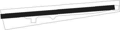
Runway info
| Runway 08 / 26 | ||
| length | 718m (2356ft) | |
| bearing | 90° / 270° | |
| width | 30m (99ft) | |
| surface | grass | |
Nearby beacons
| code | identifier | dist | bearing | frequency |
|---|---|---|---|---|
| ALP | ALPINE (ELMIRA) NDB | 7.9 | 195° | 245 |
| ITH | DME | 14.1 | 65° | 111.80 |
| IT | VRNAH (ITHACA) NDB | 16.4 | 80° | 266 |
| ULW | ELMIRA VOR/DME | 21 | 227° | 109.65 |
| PYA | PENN YAN NDB | 22 | 310° | 260 |
| CFB | BINGHAMTON VOR/DME | 29.2 | 110° | 112.20 |
| GGT | GEORGETOWN TACAN | 47.2 | 65° | 117.80 |
| SFK | STONYFORK VOR/DME | 50.8 | 226° | 108.60 |
| SYR | SYRACUSE VORTAC | 52.9 | 33° | 117 |
| FZ | FALLN (FULTON) NDB | 58.3 | 25° | 220 |
| ROC | ROCHESTER VOR/DME | 61.3 | 308° | 110 |
Disclaimer
The information on this website is not for real aviation. Use this data with the X-Plane flight simulator only! Data taken with kind consent from X-Plane 12 source code and data files. Content is subject to change without notice.