Quincy - Gansner Field
Airport details
| Country | United States of America |
| State | California |
| Region | K2 |
| Airspace | Oakland Ctr |
| Municipality | CAL Fire Lassen Modoc Plumas Unit |
| Elevation | 3415ft (1041m) |
| Timezone | GMT -8 |
| Coordinates | 39.94392, -120.94539 |
| Magnetic var | |
| Type | land |
| Available since | X-Plane v10.40 |
| ICAO code | 2O1 |
| IATA code | n/a |
| FAA code | 2O1 |
Communication
| Gansner Field CTAF/UNICOM | 122.700 |
Nearby Points of Interest:
Hospital Bridge
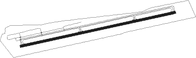
Runway info
| Runway 7 / 25 | ||
| length | 1249m (4098ft) | |
| bearing | 84° / 264° | |
| width | 18m (60ft) | |
| surface | asphalt | |
Nearby beacons
| code | identifier | dist | bearing | frequency |
|---|---|---|---|---|
| AHC | AMEDEE (HERLONG) VOR/DME | 41.3 | 68° | 109 |
| BAB | BEALE (MARYSVILLE) TACAN | 53.7 | 211° | 108.60 |
| SWR | SQUAW VALLEY(SOUTH LAKE T VOR/DME | 55.5 | 138° | 113.20 |
| MYV | MARYSVILLE VOR/DME | 58.5 | 217° | 110.80 |
Disclaimer
The information on this website is not for real aviation. Use this data with the X-Plane flight simulator only! Data taken with kind consent from X-Plane 12 source code and data files. Content is subject to change without notice.