Chowchilla
Airport details
| Country | United States of America |
| State | California |
| Region | K2 |
| Airspace | Oakland Ctr |
| Municipality | Chowchilla |
| Elevation | 242ft (74m) |
| Timezone | GMT -8 |
| Coordinates | 37.11328, -120.24700 |
| Magnetic var | |
| Type | land |
| Available since | X-Plane v11.50 |
| ICAO code | 2O6 |
| IATA code | n/a |
| FAA code | n/a |
Communication
| Chowchilla CTAF | 122.900 |
Nearby Points of Interest:
Thomas H. Leggett House
-United States Post Office (Merced, California)
-Maj. George Beecher Cook House
-Leggett House
-Bank of Italy
-Kaehler-Rector House
-Merced County High School
-Bloss Mansion
-Hornitos Masonic Hall No. 98
-Fort Miller
-Bank of Los Banos Building
-Church of St. Joseph
-Einstein House
-Fresno Bee Building
-San Joaquin Light and Power Corporation Building
-Southern Pacific Depot
-Fresno Municipal Sanitary Landfill
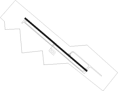
Runway info
| Runway 12 / 30 | ||
| length | 992m (3255ft) | |
| bearing | 129° / 309° | |
| width | 18m (60ft) | |
| surface | asphalt | |
| blast zone | 91m (299ft) / 91m (299ft) | |
Nearby beacons
| code | identifier | dist | bearing | frequency |
|---|---|---|---|---|
| HYP | EL NIDO (MERCED) VOR/DME | 9.7 | 305° | 114.20 |
| CZQ | CLOVIS (FRESNO) VORTAC | 24.8 | 118° | 112.90 |
| FRA | FRIANT VORTAC | 31.2 | 91° | 115.60 |
| PXN | PANOCHE VORTAC | 34.9 | 233° | 112.60 |
| MOD | MODESTO VOR/DME | 45.8 | 306° | 114.60 |
| NLC | NAVY LEMOORE TACAN | 48.1 | 160° | 113.30 |
| VIS | VISALIA VOR/DME | 57.9 | 134° | 109.40 |
| LIN | LINDEN VOR/DME | 68 | 322° | 114.80 |
Disclaimer
The information on this website is not for real aviation. Use this data with the X-Plane flight simulator only! Data taken with kind consent from X-Plane 12 source code and data files. Content is subject to change without notice.