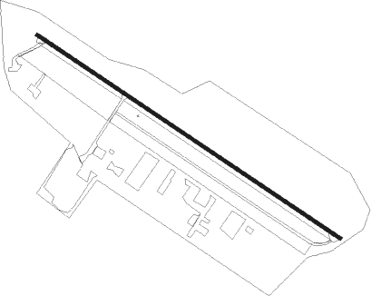
Sequim - Diamond Point Airstrip
Airport details
| Country | United States of America |
| State | Washington |
| Region | |
| Airspace | Seattle Ctr |
| Municipality | Clallam County |
| Elevation | 262ft (80m) |
| Timezone | GMT -8 |
| Coordinates | 48.09422, -122.93176 |
| Magnetic var | |
| Type | land |
| Available since | X-Plane v10.40 |
| ICAO code | 2WA1 |
| IATA code | n/a |
| FAA code | 2WA1 |
Communication
Nearby Points of Interest:
Jefferson County Courthouse
-Capt. Enoch S. Fowler House
-Rothschild House
-Methodist Episcopal Church of Port Hadlock
-Manis Mastodon Site
-New Dungeness Light
-McAlmond House
-Fort Flagler State Park
-Ebey's Landing National Historical Reserve
-Aircraft Warning Service Observation Tower
-Emery Farmstead
-Blue Mountain School
-Cama Beach State Park
-St. Andrew's Episcopal Church
-Olympic National Park Headquarters Historic District
-Naval Lodge Elks Building
-Clallam County Courthouse
-Joseph Paris House
-United States Post Office
-Masonic Temple
-Tse-whit-zen
-Deception Pass Bridge
-Stanwood IOOF Public Hall
-Elwha River Bridge
-Elwha Dam
Runway info
| Runway 10 / 28 | ||
| length | 707m (2320ft) | |
| bearing | 118° / 298° | |
| width | 7m (23ft) | |
| surface | asphalt | |
Nearby beacons
| code | identifier | dist | bearing | frequency |
|---|---|---|---|---|
| CVV | PENN COVE VOR/DME | 12.2 | 54° | 117.20 |
| NUW | WHIDBEY ISLAND (OAK HARBO TACAN | 19 | 46° | 113.80 |
| NOW | EDIZ HOOK (PORT ANGELES) NDB | 19.1 | 276° | 338 |
| FHR | FRIDAY HARBOR NDB | 25.3 | 348° | 284 |
| PAE | PAINE (EVERETT) VOR/DME | 28.2 | 105° | 110.60 |
| CL | ELWHA (PORT ANGELES) NDB | 29.7 | 274° | 515 |
| BVS | SKAGIT/BAY VIEW (BURLINGTON) NDB | 30.4 | 54° | 240 |
| AW | WATON (ARLINGTON) NDB | 31.2 | 91° | 382 |
| YJ | VICTORIA NDB | 37.9 | 320° | 200 |
| MB | MILL BAY (VICTORIA) NDB | 42.2 | 314° | 293 |
| YYJ | VICTORIA VOR/DME | 43.9 | 319° | 113.70 |
| SEA | SEATTLE VORTAC | 46.8 | 137° | 116.80 |
| AP | ACTIVE PASS NDB | 48.9 | 335° | 378 |
| HUH | WHATCOM VORTAC | 53 | 22° | 113 |
| WC | WHITE ROCK NDB | 55 | 11° | 332 |
| XX | ABBOTSFORD NDB | 58 | 26° | 344 |
| YVR | VANCOUVER VOR/DME | 59.6 | 348° | 115.90 |
| TCM | MC CHORD (TACOMA) TACAN | 59.7 | 154° | 109.60 |
Disclaimer
The information on this website is not for real aviation. Use this data with the X-Plane flight simulator only! Data taken with kind consent from X-Plane 12 source code and data files. Content is subject to change without notice.
