Stevensville
Airport details
| Country | United States of America |
| State | Montana |
| Region | K1 |
| Airspace | Salt Lake City Ctr |
| Municipality | Ravalli County |
| Elevation | 3612ft (1101m) |
| Timezone | GMT -7 |
| Coordinates | 46.52511, -114.05280 |
| Magnetic var | |
| Type | land |
| Available since | X-Plane v10.40 |
| ICAO code | 32S |
| IATA code | n/a |
| FAA code | 32S |
Communication
| Stevensville AWOS (KMSO) | 119.825 |
| Stevensville CTAF/UNICOM | 122.800 |
| Stevensville SPOKANE Approach/Departure | 124.900 |
Nearby Points of Interest:
Bass Mansion
-Albert May House
-John and Ann Williams House
-IOOF Hall
-Emhoff House
-St. Mary's Mission
-Benjamin Young House
-Martin Cramer House
-St. Mary Peak Lookout
-Traveler's Rest
-Riverside
-E.G. Ellis House
-Frank Wallin House
-Other C. Wamsley House
-Ravalli County Courthouse
-Erick Trosdahl House
-Pine Apartments
-Conway House
-John Stout House
-Fort Missoula
-Bellows Residence
-Fred T. Sterling House
-Hammond Arcade
-Bluebird Building
-Zip Auto
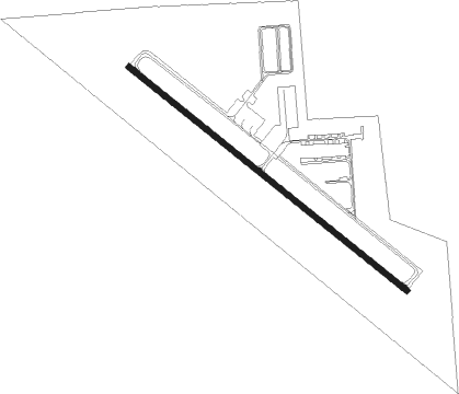
Runway info
| Runway 12 / 30 | ||
| length | 1157m (3796ft) | |
| bearing | 123° / 303° | |
| width | 18m (60ft) | |
| surface | asphalt | |
Nearby beacons
| code | identifier | dist | bearing | frequency |
|---|---|---|---|---|
| MSO | MISSOULA VOR/DME | 23 | 355° | 112.80 |
Instrument approach procedures
| runway | airway (heading) | route (dist, bearing) |
|---|---|---|
| RWNVA | MSO (175°) | MSO CEBED (8mi, 173°) 10000ft |
| RWNVA | RIVAL (117°) | RIVAL FEGUR (18mi, 94°) 10000ft CEBED (5mi, 90°) 10000ft |
| RWNVA | TAGOE (214°) | TAGOE CEBED (8mi, 271°) 10000ft |
| RNAV | CEBED 10000ft HAMID (10mi, 178°) 7100ft 32S (6mi, 174°) 6400ft (6383mi, 112°) 6400ft TAGOE (6372mi, 292°) 13000ft TAGOE (turn) 13000ft |
Disclaimer
The information on this website is not for real aviation. Use this data with the X-Plane flight simulator only! Data taken with kind consent from X-Plane 12 source code and data files. Content is subject to change without notice.