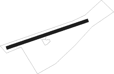
Abingdon - Old South Aerodrome
Airport details
| Country | United States of America |
| State | Virginia |
| Region | |
| Airspace | Atlanta Ctr |
| Municipality | Washington County |
| Elevation | 1970ft (600m) |
| Timezone | GMT -5 |
| Coordinates | 36.67778, -81.92872 |
| Magnetic var | |
| Type | land |
| Available since | X-Plane v10.40 |
| ICAO code | 32VA |
| IATA code | n/a |
| FAA code | 32VA |
Communication
| Old South Aerodrome CTAF | 128.800 |
Nearby Points of Interest:
Mont Calm
-Abingdon Historic District
-Dr. William H. Pitts House
-Abingdon Bank
-Moonlite Drive-In
-Edmondson Hall
-White's Mill
-Emory and Henry College
-Brook Hall
-Crabtree-Blackwell Farm
-Walnut Grove (Bristol, Virginia)
-Douglass School
-Virginia Intermont College
-Virginia Middle School
-Bristol Warehouse Historic District
-Bristol
-Euclid Avenue Historic District (Bristol, Virginia)
-Solar Hill Historic District
-Bristol Commercial Historic District
-King-Lancaster-McCoy-Mitchell House
-Virginia Hill Historic District
-A.C. Beatie House
-H.L. Bonham House
-Downtown Chilhowie Historic District
-Preston House (Saltville, Virginia)
Nearby beacons
| code | identifier | dist | bearing | frequency |
|---|---|---|---|---|
| GZG | GLADE SPRING (BLACKFORD) VOR/DME | 11.4 | 314° | 110.20 |
| JJC | MOUNTAIN CITY NDB | 16.4 | 158° | 396 |
| HMV | HOLSTON MOUNTAIN VORTAC | 17.4 | 220° | 114.60 |
| TR | MOCCA(BRISTOL-JOHNSON-KINGSPOR NDB | 20.1 | 253° | 299 |
| BAR | HEMLOCK (BANNER ELK) NDB | 31.5 | 175° | 320 |
| BO | BOOIE (BRISTOL) NDB | 32.1 | 244° | 221 |
| JUH | ASHEE (JEFFERSON) NDB | 32.7 | 112° | 410 |
| RVN | ROGERSVILLE NDB | 47.9 | 257° | 329 |
| BLF | BLUEFIELD VOR/DME | 51.6 | 49° | 110 |
| BZM | BARRETTS MOUNTAIN (HICKOR VOR/DME | 58.9 | 140° | 113.75 |
| FIQ | FIDDLERS (MORGANTON) NDB | 59.4 | 165° | 391 |
| HK | TAWBA (HICKORY) NDB | 61.4 | 145° | 332 |
Disclaimer
The information on this website is not for real aviation. Use this data with the X-Plane flight simulator only! Data taken with kind consent from X-Plane 12 source code and data files. Content is subject to change without notice.