Saint Estèphe - Saint-estephe
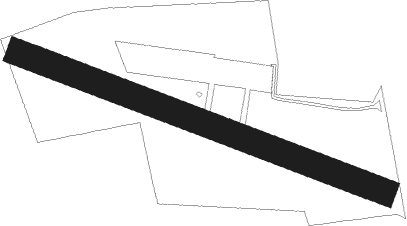
Airport details
| Country | France |
| State | Nouvelle-Aquitaine |
| Region | |
| Airspace | Bordeaux Ctr |
| Municipality | Saint-Estèphe |
| Elevation | 20ft (6m) |
| Timezone | GMT +1 |
| Coordinates | 45.23690, -0.75424 |
| Magnetic var | |
| Type | land |
| Available since | X-Plane v10.40 |
| ICAO code | 3356 |
| IATA code | n/a |
| FAA code | n/a |
Communication
| Saint-Estephe 123.500 | 123.500 |
Nearby Points of Interest:
Château Lafite Rothschild
-Way of Saint James UNESCO World Heritage Sites in France
-Château Pichon Longueville Comtesse de Lalande
-Croix de cimetière de Boisredon
-Château Margaux
-Madonna mit Kind
-Château de la Tenaille
-Château d'Agassac
-Domaine de la Seiglière
-porte de ville de Jonzac
-Immeuble Margarance
-Le Fâ
-Le Bousquet
-Château d'Ardennes
-Halles de Cozes
-Moulin de Caupian
-Éolienne du Clône
-Taufbecken
-hôtel Kerlivio-Broussard
-Château du Fa
-Château des Lauriers
-Château de Lormont
-Magasin aux vivres de Bordeaux
Nearby beacons
| code | identifier | dist | bearing | frequency |
|---|---|---|---|---|
| NB | BORDEAUX NDB | 10.1 | 114° | 361 |
| BD | BORDEAUX NDB | 19.8 | 148° | 393 |
| RY | ROYAN NDB | 23.2 | 343° | 427 |
| BMC | BORDEAUX MERIGNAC VOR/DME | 24.6 | 175° | 113.75 |
| BE | BORDEAUX NDB | 26.6 | 136° | 318 |
| CNA | COGNAC CHATEAUBERNARD VOR/DME | 31.4 | 46° | 114.65 |
| CGC | COGNAC CHATEAUBERNARD TACAN | 31.6 | 46° | 116.20 |
| OC | COGNAC NDB | 39.2 | 50° | 346 |
| ROC | ROCHEFORT NDB | 40.3 | 340° | 396 |
| SAU | SAUVETERRE DE GUYENNE VOR | 42.2 | 133° | 116.80 |
| CAA | CAZAUX NDB | 44 | 208° | 382 |
| CAA | CAZAUX TACAN | 45.3 | 208° | 110.80 |
| BRS | BISCARROSSE NDB | 54.7 | 203° | 358 |
| AGO | ANGOULEME NDB | 57.3 | 68° | 404 |
| RL | LA ROCHELLE NDB | 58.2 | 340° | 322 |
| BGC | BERGERAC NDB | 63.4 | 107° | 374 |
| PX | PERIGUEUX NDB | 70.6 | 92° | 389 |
Disclaimer
The information on this website is not for real aviation. Use this data with the X-Plane flight simulator only! Data taken with kind consent from X-Plane 12 source code and data files. Content is subject to change without notice.