Walden - Walden-jackson County
Airport details
| Country | United States of America |
| State | Colorado |
| Region | K2 |
| Airspace | Denver Ctr |
| Municipality | Jackson County |
| Elevation | 8150ft (2484m) |
| Timezone | GMT -7 |
| Coordinates | 40.75039, -106.27153 |
| Magnetic var | |
| Type | land |
| Available since | X-Plane v10.40 |
| ICAO code | 33V |
| IATA code | n/a |
| FAA code | n/a |
Communication
| Walden-Jackson County AWOS 3 | 118.625 |
| Walden-Jackson County CTAF | 122.900 |
Nearby Points of Interest:
Woods Landing Dance Hall
-Grand Ditch
-Lulu City
-Milner Pass Road Camp Mess Hall and House
-Timber Creek Campground Comfort Station No. 245
-Timber Creek Campground Comfort Station No. 246
-Timber Creek Campground Comfort Station No. 247
-Fleshut Cabin
-Fall River Pass Ranger Station
-Christian Science Society
-Crawford House
-First National Bank Building
-Chamber of Commerce Building (Steamboat Springs, Colorado)
-Steamboat Springs Depot
-Timberline Cabin
-Fall River Pump House and Catchment Basin
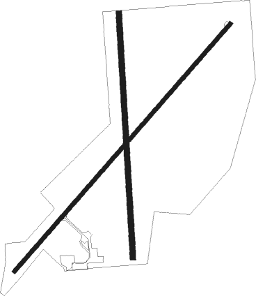
Runway info
Runway 4 / 22  | ||
| length | 1800m (5906ft) | |
| bearing | 54° / 234° | |
| width | 23m (75ft) | |
| surface | asphalt | |
| Runway 17 / 35 | ||
| length | 1336m (4383ft) | |
| bearing | 181° / 1° | |
| width | 30m (100ft) | |
| surface | dirt | |
Nearby beacons
| code | identifier | dist | bearing | frequency |
|---|---|---|---|---|
| BQZ | ROBERT (STEAMBOAT SPRINGS VOR/DME | 32.3 | 244° | 112.20 |
| LAR | LARAMIE VOR/DME | 43.2 | 43° | 117.60 |
| RLG | KREMMLING VOR/DME | 45.5 | 193° | 113.80 |
| SAA | SARATOGA NDB | 48.8 | 321° | 266 |
Departure and arrival routes
| Transition altitude | 18000ft |
| Transition level | 18000ft |
| SID end points | distance | outbound heading | |
|---|---|---|---|
| RW04 | |||
| WALRU1 | 16mi | 337° | |
| RW22 | |||
| WALRU1 | 16mi | 337° | |
Instrument approach procedures
| runway | airway (heading) | route (dist, bearing) |
|---|---|---|
| RW04 | ECHOA (70°) | ECHOA WUTIK (19mi, 82°) 12600ft |
| RW04 | WALRU (157°) | WALRU WUTIK (26mi, 196°) 12600ft WUTIK (turn) 12600ft |
| RNAV | WUTIK 12600ft JUPUS (9mi, 53°) 9800ft CORAK (3mi, 53°) 8920ft 33V (3mi, 53°) 8188ft (6141mi, 111°) 8403ft FORLI (6138mi, 291°) WALRU (15mi, 319°) 14200ft WALRU (turn) 14200ft |
Disclaimer
The information on this website is not for real aviation. Use this data with the X-Plane flight simulator only! Data taken with kind consent from X-Plane 12 source code and data files. Content is subject to change without notice.