Saint-benoît-des-ondes - Saint-meloir-des-ondes
Airport details
| Country | France |
| State | Brittany |
| Region | |
| Airspace | Brest Ctr |
| Municipality | Saint-Méloir-des-Ondes |
| Elevation | 20ft (6m) |
| Timezone | GMT +1 |
| Coordinates | 48.63522, -1.87423 |
| Magnetic var | |
| Type | land |
| Available since | X-Plane v10.40 |
| ICAO code | 3559 |
| IATA code | n/a |
| FAA code | n/a |
Communication
| Saint-Meloir-des-Ondes SAINT MELOIR DES ONDES Tower | 120.150 |
| Saint-Meloir-des-Ondes RENNES INFO | 126.950 |
Nearby Points of Interest:
Malouinière du Grand Val Ernoul
-Cale de l'Épi
-Gare de Miniac
-Malouinière du Demaine
-Malouinière de la Ville Bague
-Malouinière de la Ville Azé
-Malouinière de la Chipaudière
-Malouinière des Courtils-Launay
-Corps de garde des Daules
-Malouinière de Launay-Ravilly
-Malouinière de la Grande Gâtinais
-Retranchement de l'âge du Fer de la pointe du Meinga
-Malouinière de la Plussinais
-Malouinière du Bosc
-Maison du Peuple de Saint-Malo
-Pointe de la Varde
-Ar Zenith
-Pont roulant de Saint-Malo à Saint-Servan
-Cale sèche de la Landriais
-Hôtel Magon de la Lande
-Hôtel Hay
-Maison, 3 rue d'Orléans, Saint-Malo
-Solidor Tower
-Hôtel de la Gicquelais
-Rance Tidal Power Station
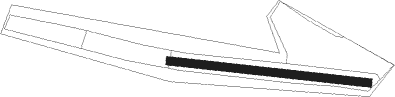
Runway info
| Runway 10 / 28 | ||
| length | 232m (761ft) | |
| bearing | 97° / 277° | |
| width | 9m (30ft) | |
| surface | grass | |
Nearby beacons
| code | identifier | dist | bearing | frequency |
|---|---|---|---|---|
| DIN | DINARD PLEURTUIT SAINT MA VOR/DME | 8.7 | 257° | 114.30 |
| REN | RENNES SAINT JACQUES VOR/DME | 34.3 | 167° | 109.25 |
| JSY | JERSEY VOR/DME | 35.8 | 344° | 112.20 |
| SB | SAINT BRIEUC NDB | 36.2 | 266° | 353 |
| JW | JERSEY NDB | 36.8 | 329° | 329 |
| PNT | PONTIVY NDB | 50.7 | 238° | 377 |
| GUR | GUERNSEY VOR/DME | 56 | 318° | 109.40 |
| VA | VANNES NDB | 60.8 | 222° | 342 |
Disclaimer
The information on this website is not for real aviation. Use this data with the X-Plane flight simulator only! Data taken with kind consent from X-Plane 12 source code and data files. Content is subject to change without notice.