Union County Troy Shelton
Airport details
| Country | United States of America |
| State | South Carolina |
| Region | K7 |
| Airspace | Atlanta Ctr |
| Municipality | Union County |
| Elevation | 608ft (185m) |
| Timezone | GMT -5 |
| Coordinates | 34.68695, -81.64117 |
| Magnetic var | |
| Type | land |
| Available since | X-Plane v10.40 |
| ICAO code | 35A |
| IATA code | n/a |
| FAA code | n/a |
Communication
| Union County Troy Shelton CTAF/UNICOM | 122.700 |
| Union County Troy Shelton GREER Approach/Departure | 119.400 |
Nearby Points of Interest:
Union Community Hospital
-Union County Jail
-Merridun
-Main Street Grammar School
-Meng House
-Judge Thomas Dawkins House
-Culp House
-Gov. Thomas B. Jeter House
-Herndon Terrace
-Cedar Bluff
-Nathaniel Gist House
-Woodland Plantation
-Means House (Jonesville, South Carolina)
-McWhirter House
-Hillside
-Camp Hill, Glenn Springs, South Carolina
-Fishdam Ford
-Williams Place
-William Dixon Fowler House
-Pinckneyville
-Pacolet Mills Historic District
-Mountain Shoals Plantation
-Golightly-Dean House
-Price's Post Office
-Thornwell-Presbyterian College Historic District
Runway info
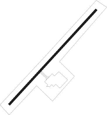
| Runway 5 / 23 | ||
| length | 1070m (3510ft) | |
| bearing | 53° / 233° | |
| width | 18m (60ft) | |
| surface | asphalt | |
Nearby beacons
| code | identifier | dist | bearing | frequency |
|---|---|---|---|---|
| UOT | UNION COUNTY NDB | 0.1 | 202° | 326 |
| DCM | CHESTER NDB | 22.5 | 77° | 220 |
| EOE | ENOREE (NEWBERRY) NDB | 22.5 | 179° | 278 |
| SPA | SPARTANBURG VORTAC | 25.1 | 320° | 115.70 |
| UZ | RALLY (ROCK HILL) NDB | 30.2 | 70° | 227 |
| SLP | FIRST RIVER (SHELBY) NDB | 34 | 4° | 417 |
| GIW | CORONACA (GREENWOOD) NDB | 34.1 | 226° | 239 |
| GM | JUDKY (GREENVILLE) NDB | 35.4 | 277° | 521 |
| GRD | GREENWOOD VORTAC | 36.4 | 230° | 115.50 |
| GHJ | STONIA (GASTONIA) NDB | 38.5 | 44° | 260 |
| LKR | LANCASTER NDB | 38.6 | 87° | 400 |
| GY | DYANA (GREENVILLE) NDB | 39.6 | 270° | 338 |
| CLT | CHARLOTTE VOR/DME | 45.4 | 54° | 115 |
| CA | MURRY (COLUMBIA) NDB | 47.4 | 151° | 362 |
| SUG | SUGARLOAF MT. (ASHEVILLE) VORTAC | 53 | 319° | 112.20 |
| BRA | BROAD RIVER (ASHEVILLE) NDB | 53.9 | 305° | 379 |
| CAE | COLUMBIA VORTAC | 57.7 | 145° | 114.70 |
| MMT | MC ENTIRE (COLUMBIA) VORTAC | 61.8 | 132° | 113.20 |
| IRQ | COLLIERS VORTAC | 64.2 | 208° | 113.90 |
| IM | KEANS (ASHEVILLE) NDB | 68.8 | 312° | 357 |
Instrument approach procedures
| runway | airway (heading) | route (dist, bearing) |
|---|---|---|
| RW05 | WOTLI (17°) | WOTLI 3500ft ZONLU (8mi, 312°) 3500ft |
| RW05 | YUNUC (82°) | YUNUC 3500ft ZONLU (8mi, 132°) 3500ft |
| RW05 | ZONLU (52°) | ZONLU 3500ft |
| RNAV | ZONLU 3500ft WIVDI (8mi, 52°) 1900ft 35A (4mi, 53°) 613ft (4993mi, 113°) 1010ft ZONLU (5001mi, 293°) 3500ft ZONLU (turn) | |
| RW23 | BUILD (137°) | BUILD JIMOM (11mi, 62°) 3500ft TUCOP (8mi, 132°) 3500ft |
| RW23 | WILLS (329°) | WILLS JUKAK (16mi, 37°) 3500ft TUCOP (8mi, 312°) 3500ft |
| RNAV | TUCOP 3500ft FIVPI (8mi, 233°) 1900ft WUBOL (2mi, 233°) 1400ft 35A (3mi, 233°) 650ft ZONLU (12mi, 232°) 3500ft ZONLU (turn) |
Disclaimer
The information on this website is not for real aviation. Use this data with the X-Plane flight simulator only! Data taken with kind consent from X-Plane 12 source code and data files. Content is subject to change without notice.