Moro - Wasco State
Airport details
| Country | United States of America |
| State | Oregon |
| Region | K1 |
| Airspace | Seattle Ctr |
| Municipality | Sherman County |
| Elevation | 1500ft (457m) |
| Timezone | GMT -8 |
| Coordinates | 45.58921, -120.67399 |
| Magnetic var | |
| Type | land |
| Available since | X-Plane v10.40 |
| ICAO code | 35S |
| IATA code | n/a |
| FAA code | n/a |
Communication
| WASCO STATE CTAF | 122.900 |
Nearby Points of Interest:
Columbia Southern Railway Passenger Station and Freight Warehouse
-DeMoss Springs Park
-First Day Advent Christian Church
-John and Helen Moore House
-Sherman County Courthouse
-Goldendale Free Public Library
-Indian Shaker Church and Gulick Homestead
-Joseph D. and Margaret Kelly House
-Sharp Family Residential Ensemble
-Dr. J. A. Reuter House
-The Dalles Carnegie Library
-The Dalles Commercial Historic District
-John and Murta Van Dellen House
-Fulton–Taylor House
-U.S. Post Office
-Heimrich–Seufert House
-John L. Thompson House
-Orlando Humason House
-Edward French House
-Rock Fort Campsite
-Hugh Glenn House
-Trevitt's Addition Historic District
-Bennett–Williams House
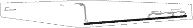
Runway info
| Runway 7 / 25 | ||
| length | 1048m (3438ft) | |
| bearing | 90° / 270° | |
| width | 18m (60ft) | |
| surface | asphalt | |
Nearby beacons
| code | identifier | dist | bearing | frequency |
|---|---|---|---|---|
| LTJ | KLICKITAT (THE DALLES) VOR/DME | 19.4 | 286° | 112.30 |
| YKM | YAKIMA VORTAC | 59.6 | 13° | 116 |
| IMB | KIMBERLY VOR/DME | 69.6 | 134° | 115.60 |
Disclaimer
The information on this website is not for real aviation. Use this data with the X-Plane flight simulator only! Data taken with kind consent from X-Plane 12 source code and data files. Content is subject to change without notice.