Salem - Salem Airpark
Airport details
| Country | United States of America |
| State | Ohio |
| Region | K5 |
| Airspace | Cleveland Ctr |
| Municipality | Mahoning County |
| Elevation | 1162ft (354m) |
| Timezone | GMT -5 |
| Coordinates | 40.94808, -80.86208 |
| Magnetic var | |
| Type | land |
| Available since | X-Plane v10.40 |
| ICAO code | 38D |
| IATA code | n/a |
| FAA code | n/a |
Communication
| Salem Airpark CTAF/UNICOM | 122.700 |
| Salem Airpark AKRON CANTON Approach/Departure | 125.500 |
Nearby Points of Interest:
John Street House
-Burchfield Homestead
-South Lincoln Avenue Historic District
-Daniel Howell Hise House
-Cherry Valley Coke Ovens
-Franklin Harris Farmstead
-Charles Nelson Schmick House
-Jones-Bowman House
-Austintown Log House
-Columbiana County Infirmary
-Alliance Clay Product Company
-Hanna-Kenty House
-Alliance Bank Building
-Eagles Building-Strand Theater
-Columbiana County Courthouse
-Haines House
-Hiram Bell Farmstead
-Nicholas Eckis House
-Youngstown station
-Metropolitan Tower
-Liberty Theatre
-Wick Building
-Masonic Temple
-YWCA Youngstown
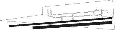
Runway info
Runway 10L / 28R  | ||
| length | 1035m (3396ft) | |
| bearing | 90° / 270° | |
| width | 15m (50ft) | |
| surface | asphalt | |
| displ threshold | 0m (0ft) / 79m (259ft) | |
| Runway 10R / 28L | ||
| length | 788m (2585ft) | |
| bearing | 90° / 270° | |
| width | 26m (85ft) | |
| surface | grass | |
Nearby beacons
| code | identifier | dist | bearing | frequency |
|---|---|---|---|---|
| ACO | AKRON VOR/DME | 18.1 | 295° | 114.40 |
| YN | FETCH (YOUNGSTOWN/WARREN) NDB | 19.3 | 46° | 338 |
| UCP | CASTLE (NEW CASTLE) NDB | 20.7 | 80° | 272 |
| YNG | YOUNGSTOWN VORTAC | 24.5 | 26° | 109 |
| AK | AKRON NDB | 24.9 | 283° | 362 |
| BSV | BRIGGS VOR/DME | 28.7 | 250° | 112.40 |
| EWC | ELLWOOD CITY VOR/DME | 30.4 | 101° | 115.80 |
| CXR | CHARDON VOR/DME | 36.7 | 332° | 112.70 |
| MMJ | (PITTSBURGH) DME | 41 | 125° | 112 |
| CFX | CADIZ NDB | 43.2 | 192° | 239 |
| HLG | WHEELING VOR/DME | 43.4 | 157° | 112.20 |
| JFN | JEFFERSON VOR/DME | 49 | 8° | 115.20 |
| BF | TABEY (CLEVELAND) NDB | 49.2 | 311° | 248 |
| LQL | LAKELAND (WILLOUGHBY) NDB | 49.8 | 325° | 263 |
| CTW | DME | 51.4 | 221° | 111.80 |
| AGC | ALLEGHENY (PITTSBURGH) VOR/DME | 54.9 | 129° | 110 |
| AIR | BELLAIRE VOR/DME | 55.9 | 177° | 117.10 |
Disclaimer
The information on this website is not for real aviation. Use this data with the X-Plane flight simulator only! Data taken with kind consent from X-Plane 12 source code and data files. Content is subject to change without notice.