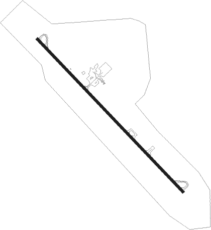
Deer Lodge - Deer Lodge-city-county
Airport details
| Country | United States of America |
| State | Montana |
| Region | K1 |
| Airspace | Salt Lake City Ctr |
| Municipality | Powell County |
| Elevation | 4690ft (1430m) |
| Timezone | GMT -7 |
| Coordinates | 46.38783, -112.76495 |
| Magnetic var | |
| Type | land |
| Available since | X-Plane v10.40 |
| ICAO code | 38S |
| IATA code | n/a |
| FAA code | 38S |
Communication
| Deer Lodge-City-County AWOS-AV | 120.025 |
| Deer Lodge-City-County CTAF | 122.900 |
Nearby Points of Interest:
Montana State Prison
-Deer Lodge American Women's League Chapter House
-Grant-Kohrs Ranch National Historic Site
-Anaconda City Hall
-Ancient Order of Hibernians Hall
-Club Moderne
-Anaconda Commercial Historic District
-Barich Block
-Deer Lodge County Courthouse
-Miners Union Hall
-Butte, Anaconda and Pacific Railway Historic District
-Granite County Jail
-Philipsburg Historic District (Philipsburg, Montana)
-Mike Mansfield Federal Building and United States Courthouse
-Dumas Brothel
-Matt's Place Drive-In
-Socialist Hall
-Silver Bow County Poor Farm Hospital
-Montana Deaf and Dumb Asylum
Runway info
| Runway 13 / 31 | ||
| length | 1766m (5794ft) | |
| bearing | 130° / 310° | |
| width | 23m (75ft) | |
| surface | asphalt | |
| blast zone | 0m (0ft) / 64m (210ft) | |
Nearby beacons
| code | identifier | dist | bearing | frequency |
|---|---|---|---|---|
| CPN | COPPERTOWN (BUTTE) VOR/DME | 21.3 | 177° | 111.60 |
| HLN | HELENA VORTAC | 36 | 75° | 117.70 |
| HIA | WHITEHALL VOR/DME | 40.1 | 131° | 113.70 |
Instrument approach procedures
| runway | airway (heading) | route (dist, bearing) |
|---|---|---|
| RWNVA | CPN (357°) | CPN 11100ft ZISON (10mi, 345°) 8300ft |
| RNAV | ZISON 8300ft AYUNO (5mi, 17°) 6900ft CITSU (7mi, 0°) 6300ft (6335mi, 112°) 6300ft JOGUT (6333mi, 292°) APICI (14mi, 284°) WAKIX (14mi, 244°) 13000ft WAKIX (turn) |
Disclaimer
The information on this website is not for real aviation. Use this data with the X-Plane flight simulator only! Data taken with kind consent from X-Plane 12 source code and data files. Content is subject to change without notice.
