Morton - Strom Field
Airport details
| Country | United States of America |
| State | Washington |
| Region | |
| Airspace | Seattle Ctr |
| Municipality | Lewis County |
| Elevation | 950ft (290m) |
| Timezone | GMT -8 |
| Coordinates | 46.55036, -122.27024 |
| Magnetic var | |
| Type | land |
| Available since | X-Plane v10.40 |
| ICAO code | 39P |
| IATA code | n/a |
| FAA code | 39P |
Communication
Nearby Points of Interest:
Randle Ranger Station-Work Center
-Ashford Mansion
-Nisqually Entrance Historic District
-Lake George Patrol Cabin
-South Puyallup River Bridge
-Longmire Campground Comfort Station No. L-303
-Longmire Campground Comfort Station No. L-302
-Longmire General Store
-Longmire Community Building
-Longmire Library
-Longmire Buildings
-St. Andrews Creek Bridge
-Indian Henry's Patrol Cabin
-Christine Falls Bridge
-Sunset Park Patrol Cabin
-Narada Falls Comfort Station
-Paradise Ranger Station
-Mount Rainier National Historic Landmark District
-Paradise Historic District
-Edith Creek Chlorination House
-Edith Creek Bridge
-Paradise River Fourth Crossing Bridge
-Stevens Creek Bridge
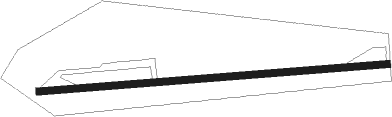
Runway info
| Runway 7 / 25 | ||
| length | 549m (1801ft) | |
| bearing | 90° / 270° | |
| width | 11m (35ft) | |
| surface | asphalt | |
| displ threshold | 60m (197ft) / 60m (197ft) | |
Nearby beacons
| code | identifier | dist | bearing | frequency |
|---|---|---|---|---|
| OLM | OLYMPIA VORTAC | 36.2 | 304° | 113.40 |
| TCM | MC CHORD (TACOMA) TACAN | 36.8 | 341° | 109.60 |
| BTG | BATTLE GROUND VORTAC | 50 | 202° | 116.60 |
| SEA | SEATTLE VORTAC | 53.1 | 357° | 116.80 |
| CBU | COLUMBIA (PORTLAND) TACAN | 59.4 | 200° | 109.20 |
| PND | BANKS (PORTLAND) NDB | 64 | 220° | 356 |
Disclaimer
The information on this website is not for real aviation. Use this data with the X-Plane flight simulator only! Data taken with kind consent from X-Plane 12 source code and data files. Content is subject to change without notice.