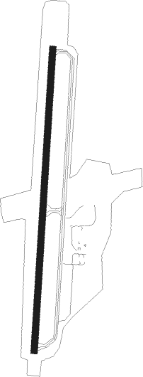
Southbridge - Southbridge Muni
Airport details
| Country | United States of America |
| State | Massachusetts |
| Region | K6 |
| Airspace | Boston Ctr |
| Municipality | Southbridge |
| Elevation | 699ft (213m) |
| Timezone | GMT -5 |
| Coordinates | 42.10111, -72.03883 |
| Magnetic var | |
| Type | land |
| Available since | X-Plane v10.40 |
| ICAO code | 3B0 |
| IATA code | n/a |
| FAA code | n/a |
Communication
| Southbridge Muni CTAF/UNICOM | 122.800 |
| Southbridge Muni BRADLEY Approach/Departure | 119.000 |
Nearby Points of Interest:
William McKinstry Farmhouse
-William McKinstry, Jr. House
-Cliff Cottage
-Building at 25–27 River Street
-Building at 29–31 River Street
-Hamilton Woolen Company Historic District
-William E. Alden House
-Evangelical Free Church
-Alexis Boyer House
-Alden-Delahanty Block
-St. Peter's Roman Catholic Church-St. Mary's School
-Chamberlain-Bordeau House
-Chapin Block
-Hamilton Millwright–Agent's House
-Hamilton Mill Brick House
-Academie Brochu
-Napoleon LaRochelle Two-Family House
-Globe Village Fire House
-James Gleason Cottage
-A. Kinney House
-J.M. Cheney Rental House
-Hamilton Mill-West Street Factory Housing
-E. B. Cummings House
-Building at 38–42 Worcester Street
-George Sumner House
Nearby beacons
| code | identifier | dist | bearing | frequency |
|---|---|---|---|---|
| PUT | PUTNAM VOR/DME | 12.3 | 127° | 117.40 |
| CEF | WESTOVER(SPRINGFIELD/CHIC TACAN | 22.4 | 281° | 114 |
| GDM | GARDNER VOR/DME | 26.7 | 358° | 110.60 |
| BAF | BARNES (WESTFIELD/SPRINGF VORTAC | 30.3 | 275° | 113 |
| ORW | NORWICH VOR/DME | 32.7 | 176° | 110 |
| PVD | PROVIDENCE VOR/DME | 35.4 | 122° | 115.60 |
| HFD | HARTFORD VOR/DME | 35.7 | 228° | 114.90 |
| OW | STOGE (NORWOOD) NDB | 40.5 | 89° | 397 |
| CTR | CHESTER VOR/DME | 42 | 282° | 115.10 |
| EEN | DME | 43.1 | 340° | 109.40 |
| GON | GROTON VOR/DME | 46.2 | 181° | 110.85 |
| MJ | FITZY (MANCHESTER) NDB | 51 | 34° | 209 |
| MHT | MANCHESTER VOR/DME | 54.7 | 41° | 114.40 |
| MAD | MADISON VOR/DME | 55.6 | 220° | 110.40 |
| LWM | DME | 56.7 | 56° | 112.50 |
| SEY | SANDY POINT (BLOCK ISLAND VOR/DME | 59.7 | 154° | 117.80 |
| HVN | HAVEN DME | 63 | 225° | 109.80 |
Instrument approach procedures
| runway | airway (heading) | route (dist, bearing) |
|---|---|---|
| RW02 | DVANY (48°) | DVANY BOBHO (6mi, 65°) 2800ft UZAZU (5mi, 96°) 2600ft |
| RW02 | PVD (302°) | PVD LIGDE (26mi, 288°) 2600ft UZAZU (5mi, 276°) 2600ft |
| RNAV | UZAZU 2600ft ZAGAR (6mi, 11°) 2500ft KIXLO (2mi, 11°) 1680ft 3B0 (3mi, 11°) 729ft JENBE (5mi, 11°) RURBY (8mi, 276°) WITNY (9mi, 191°) 3000ft WITNY (turn) |
Disclaimer
The information on this website is not for real aviation. Use this data with the X-Plane flight simulator only! Data taken with kind consent from X-Plane 12 source code and data files. Content is subject to change without notice.
