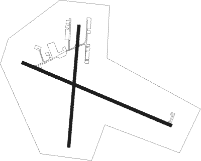
Greenville - Greenville Muni
Airport details
| Country | United States of America |
| State | Maine |
| Region | K6 |
| Airspace | Boston Ctr |
| Municipality | Greenville |
| Elevation | 1399ft (426m) |
| Timezone | GMT -5 |
| Coordinates | 45.46283, -69.55165 |
| Magnetic var | |
| Type | land |
| Available since | X-Plane v10.40 |
| ICAO code | 3B1 |
| IATA code | n/a |
| FAA code | n/a |
Communication
| Greenville Muni CTAF/UNICOM | 122.800 |
Nearby Points of Interest:
William M. Shaw House
-Katahdin
-Gulf Hagas
-Swedish Lutheran Church
-Monson Engine House
-Kineo Cottage Row Historic District
-Guilford Memorial Library
-Observer Building
-James Sullivan Wiley House
-Milo Public Library
-Former Free Will Baptist Church
-Bingham Free Meetinghouse
Nearby beacons
| code | identifier | dist | bearing | frequency |
|---|---|---|---|---|
| BUP | BURNHAM (PITTSFIELD) NDB | 46.6 | 166° | 348 |
| BGR | BANGOR VORTAC | 47 | 133° | 114.80 |
Instrument approach procedures
| runway | airway (heading) | route (dist, bearing) |
|---|---|---|
| RW14 | BGR (313°) | BGR WELUG (61mi, 308°) 5500ft WELUG (turn) 4700ft |
| RW14 | ZANAK (160°) | ZANAK WELUG (12mi, 229°) 4700ft |
| RNAV | WELUG 4700ft KAKPE (7mi, 121°) 3700ft 3B1 (7mi, 110°) 1424ft (4553mi, 123°) 2800ft WELUG (4567mi, 303°) 5000ft WELUG (turn) |
Disclaimer
The information on this website is not for real aviation. Use this data with the X-Plane flight simulator only! Data taken with kind consent from X-Plane 12 source code and data files. Content is subject to change without notice.

