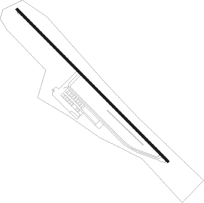
Sterling
Airport details
| Country | United States of America |
| State | Massachusetts |
| Region | |
| Airspace | Boston Ctr |
| Municipality | Sterling |
| Elevation | 458ft (140m) |
| Timezone | GMT -5 |
| Coordinates | 42.42610, -71.79515 |
| Magnetic var | |
| Type | land |
| Available since | X-Plane v10.40 |
| ICAO code | 3B3 |
| IATA code | n/a |
| FAA code | 3B3 |
Communication
| Sterling CTAF | 122.900 |
Nearby Points of Interest:
Oakdale Village Historic District
-Stephen Hastings House
-Sawyer Homestead
-Manning-Ball House
-Russell Corner Historic District
-Bigelow Tavern Historic District
-Princeton Center Historic District
-Benjamin Flagg House
-Bigelow Carpet Company Woolen Mills
-Fernside-Vacation House for Working Girls
-Bigelow Carpet Mill
-Downtown Clinton Historic District
-Willard-Fisk House
-First Methodist Church
-Corcoran School
-Wachusett Aqueduct
-Founder's Hall
-South Lancaster Engine House
-Rogers House
-Nathaniel Thayer Estate
-Ezra Rice House
-Bowers School
-Hubbard-Dawson House
-Center Village District
-North Village Historic District
Nearby beacons
| code | identifier | dist | bearing | frequency |
|---|---|---|---|---|
| GDM | GARDNER VOR/DME | 13.6 | 294° | 110.60 |
| PUT | PUTNAM VOR/DME | 28.3 | 186° | 117.40 |
| MJ | FITZY (MANCHESTER) NDB | 28.8 | 31° | 209 |
| EEN | DME | 31.1 | 307° | 109.40 |
| MHT | MANCHESTER VOR/DME | 32.5 | 44° | 114.40 |
| OW | STOGE (NORWOOD) NDB | 34.8 | 115° | 397 |
| CEF | WESTOVER(SPRINGFIELD/CHIC TACAN | 35.2 | 253° | 114 |
| BOS | BOSTON VOR/DME | 35.9 | 95° | 112.70 |
| LWM | DME | 36.2 | 66° | 112.50 |
| BAF | BARNES (WESTFIELD/SPRINGF VORTAC | 43.8 | 254° | 113 |
| CO | EPSOM (CONCORD) NDB | 44.2 | 26° | 216 |
| PVD | PROVIDENCE VOR/DME | 45.1 | 152° | 115.60 |
| CON | CONCORD VOR/DME | 48.6 | 15° | 112.90 |
| ORW | NORWICH VOR/DME | 53 | 193° | 110 |
| HFD | HARTFORD VOR/DME | 57.8 | 224° | 114.90 |
| PSM | (PORTSMOUTH) DME | 58 | 56° | 116.50 |
| CNH | CLAREMONT NDB | 62 | 329° | 233 |
| ESG | ROLLINS (ROLLINSFORD) NDB | 63.9 | 51° | 260 |
| SF | SANFD (SANFORD) NDB | 69 | 47° | 349 |
Disclaimer
The information on this website is not for real aviation. Use this data with the X-Plane flight simulator only! Data taken with kind consent from X-Plane 12 source code and data files. Content is subject to change without notice.
