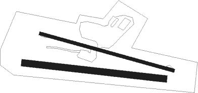
Greene - Twitchell
Airport details
| Country | United States of America |
| State | Maine |
| Region | K6 |
| Airspace | Boston Ctr |
| Municipality | Turner |
| Elevation | 354ft (108m) |
| Timezone | GMT -5 |
| Coordinates | 44.18895, -70.23286 |
| Magnetic var | |
| Type | land |
| Available since | X-Plane v10.40 |
| ICAO code | 3B5 |
| IATA code | n/a |
| FAA code | n/a |
Communication
| Twitchell CTAF/UNICOM | 122.800 |
Nearby Points of Interest:
William Briggs Homestead
-John D. Clifford House
-Bradford Peck House
-James C. Lord House
-Turner Town House
-Main Street – Frye Street Historic District
-Sen. William P. Frye House
-Hathorn Hall
-Holland-Drew House
-Captain Holland House
-Gay-Munroe House
-Kora Temple
-Jordan School
-Marcotte Nursing Home
-Holman Day House
-Frank L. Dingley House
-Auburn Public Library
-First National Bank
-Saint Mary's Regional Medical Center
-Androscoggin County Courthouse and Jail
-Union Block
-Lewiston Trust and Safe Deposit Company
-Engine House
-Auburn Commercial Historic District
-Lyceum Hall
Nearby beacons
| code | identifier | dist | bearing | frequency |
|---|---|---|---|---|
| LE | LEWIE (AUBURN-LEWISTON) NDB | 14.3 | 205° | 240 |
| AUG | AUGUSTA VOR/DME | 20.3 | 73° | 114.95 |
| AU | DUNNS (AUGUSTA) NDB | 20.8 | 59° | 366 |
| BUP | BURNHAM (PITTSFIELD) NDB | 48.3 | 60° | 348 |
| ENE | KENNEBUNK VOR/DME | 48.7 | 207° | 117.10 |
| BML | DME | 48.8 | 295° | 116.55 |
| RQM | RANGELEY NDB | 49.9 | 325° | 221 |
| SF | SANFD (SANFORD) NDB | 57.5 | 215° | 349 |
| ESG | ROLLINS (ROLLINSFORD) NDB | 63.6 | 212° | 260 |
Disclaimer
The information on this website is not for real aviation. Use this data with the X-Plane flight simulator only! Data taken with kind consent from X-Plane 12 source code and data files. Content is subject to change without notice.

