Calverton Executive Airpark
Airport details
| Country | United States of America |
| State | New York |
| Region | K6 |
| Airspace | Boston Ctr |
| Municipality | Town of Riverhead |
| Elevation | 75ft (23m) |
| Timezone | GMT -5 |
| Coordinates | 40.91510, -72.79191 |
| Magnetic var | |
| Type | land |
| Available since | X-Plane v10.40 |
| ICAO code | 3C8 |
| IATA code | n/a |
| FAA code | n/a |
Communication
Nearby Points of Interest:
Tuthill-Lapham House
-Josiah Woodhull House
-Suffolk County Historical Society Building
-United States Post Office
-Vail-Leavitt Music Hall
-Smith Estate
-Homan-Gerard House and Mills
-Big Duck Ranch
-Suffolk County Almshouse Barn
-James Benjamin Homestead
-Masury Estate Ballroom
-Middle Island Presbyterian Church
-Robert Hawkins Homestead
-William Floyd House
-Davis Town Meeting House
-Foster-Meeker House
-Miller Place Historic District
-Crowther House
-Jamesport Meeting House
-Jedediah Hawkins House
-Hallock-Bilunas Farmstead
-Hallock Homestead
-Samuel Hopkins House
-Quogue Historic District
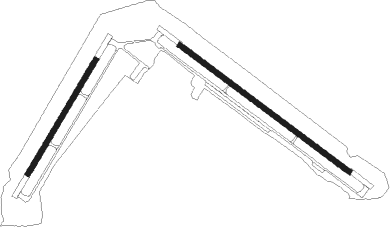
Runway info
Runway 14 / 32  | ||
| length | 2439m (8002ft) | |
| bearing | 124° / 304° | |
| width | 61m (200ft) | |
| surface | asphalt | |
| Runway 5 / 23 | ||
| length | 1525m (5003ft) | |
| bearing | 43° / 223° | |
| width | 61m (200ft) | |
| surface | asphalt | |
Nearby beacons
| code | identifier | dist | bearing | frequency |
|---|---|---|---|---|
| CCC | CALVERTON VOR/DME | 0.9 | 334° | 117.20 |
| FOK | SUFFOLK CO (WESTHAMPTON B TACAN | 8.6 | 116° | 111 |
| BDR | BRIDGEPORT VOR/DME | 21 | 306° | 108.80 |
| HVN | HAVEN DME | 21.2 | 345° | 109.80 |
| HTO | HAMPTON (EAST HAMPTON) VORTAC | 21.5 | 90° | 113.60 |
| DPK | DEER PARK VOR/DME | 24.3 | 256° | 117.70 |
| MAD | MADISON VOR/DME | 24.3 | 14° | 110.40 |
| FR | FRIKK (FARMINGDALE) NDB | 32.4 | 259° | 407 |
| GON | GROTON VOR/DME | 41.7 | 61° | 110.85 |
| CMK | CARMEL VOR/DME | 41.9 | 295° | 116.60 |
| HFD | HARTFORD VOR/DME | 44.9 | 19° | 114.90 |
| JFK | KENNEDY (NEW YORK) VOR/DME | 47.6 | 254° | 115.90 |
| ORW | NORWICH VOR/DME | 52.5 | 51° | 110 |
| PWL | PAWLING (POUGHKEEPSIE) VOR/DME | 62.9 | 317° | 114.30 |
Disclaimer
The information on this website is not for real aviation. Use this data with the X-Plane flight simulator only! Data taken with kind consent from X-Plane 12 source code and data files. Content is subject to change without notice.