Lake In The Hills
Airport details
| Country | United States of America |
| State | Illinois |
| Region | K5 |
| Airspace | Chicago Ctr |
| Municipality | Lake in the Hills |
| Elevation | 888ft (271m) |
| Timezone | GMT -6 |
| Coordinates | 42.20681, -88.32300 |
| Magnetic var | |
| Type | land |
| Available since | X-Plane v10.40 |
| ICAO code | 3CK |
| IATA code | n/a |
| FAA code | 3CK |
Communication
| Lake in the Hills CTAF/UNICOM | 123.050 |
| Lake in the Hills CHICAGO Approach/Departure | 120.550 |
Nearby Points of Interest:
Christian Geister House
-St. Mary's Church of Gilberts
-Dundee Township Historic District
-George Stickney House
-Terwilliger House
-Teeple Barn
-Milk Pail Restaurant
-Old McHenry County Courthouse
-Octagon House
-Barrington Historic District
-Jewel Tea Company, Inc. building
-Spring–Douglas Historic District
-Wing Park Golf Course
-Larkin Home for Children
-Elgin Downtown Commercial District
-First Universalist Church
-Elgin Historic District
-Gifford-Davidson House
-Ora Pelton House
-Robert and Elizabeth Muirhead House
-Orson Rogers House
-Charles H. Hibbard House
-Charles H. Patten House
-George Clayson House
-Buffalo Creek Bridge
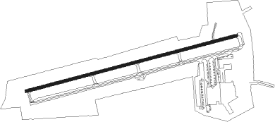
Runway info
| Runway 8 / 26 | ||
| length | 1155m (3789ft) | |
| bearing | 82° / 262° | |
| width | 15m (50ft) | |
| surface | asphalt | |
| displ threshold | 111m (364ft) / 118m (387ft) | |
| blast zone | 0m (0ft) / 27m (89ft) | |
Nearby beacons
| code | identifier | dist | bearing | frequency |
|---|---|---|---|---|
| OBK | NORTHBROOK VOR/DME | 16.5 | 88° | 113 |
| DPA | DUPAGE (CHICAGO) VOR/DME | 19 | 185° | 108.40 |
| GCO | DME | 22.6 | 117° | 108.25 |
| UG | WAUKE (CHICAGO/WAUKEGAN) NDB | 27.8 | 64° | 379 |
| BUU | (BURLINGTON) DME | 28.9 | 3° | 114.50 |
| ENW | DME | 29.2 | 45° | 109.20 |
| RA | PASER (RACINE) NDB | 34.1 | 42° | 206 |
| RFD | DME | 38.9 | 271° | 110.80 |
| JOT | JOLIET VOR/DME | 39.6 | 180° | 112.30 |
| MX | KEDZI (CHICAGO) NDB | 39.7 | 126° | 248 |
| HRK | (RACINE) DME | 40.2 | 42° | 117.70 |
| JVL | JANESVILLE VOR/DME | 40.6 | 294° | 114.30 |
| CGT | CHICAGO HEIGHTS VORTAC | 53.6 | 133° | 114.20 |
| BAE | BADGER (MILWAUKEE) VOR/DME | 54.6 | 2° | 116.40 |
| LJT | (MILWAUKEE) DME | 55.6 | 18° | 115.65 |
| GY | GARIE (GARY) NDB | 58.5 | 123° | 236 |
| RYV | ROCK RIVER (WATERTOWN) NDB | 60.7 | 337° | 371 |
| EON | PEOTONE VORTAC | 61.1 | 150° | 113.20 |
Instrument approach procedures
| runway | airway (heading) | route (dist, bearing) |
|---|---|---|
| RW08 | KRENA (134°) | KRENA TONIC (12mi, 194°) 2600ft TONIC (turn) 2500ft |
| RW08 | NUELG (56°) | NUELG TONIC (12mi, 29°) 2500ft |
| RNAV | TONIC 2500ft CRYSL (5mi, 82°) 2500ft ZINUG (3mi, 82°) 1500ft 3CK (2mi, 82°) 925ft (5331mi, 116°) 1287ft EHUHY (5321mi, 296°) 2500ft EHUHY (turn) | |
| RW26 | GRIFT (98°) | GRIFT EHUHY (36mi, 94°) 2600ft EHUHY (turn) 2500ft |
| RW26 | KRENA (134°) | KRENA IJBIJ (17mi, 98°) 2500ft EHUHY (5mi, 166°) 2500ft |
| RNAV | EHUHY 2500ft UBHOD (5mi, 262°) 2400ft 3CK (5mi, 262°) 925ft (5331mi, 116°) 1800ft EHUHY (5321mi, 296°) 2500ft EHUHY (turn) |
Disclaimer
The information on this website is not for real aviation. Use this data with the X-Plane flight simulator only! Data taken with kind consent from X-Plane 12 source code and data files. Content is subject to change without notice.