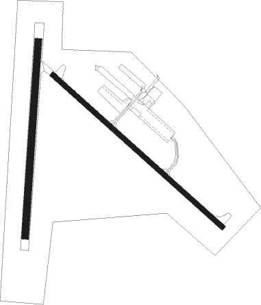
Ephraim - Ephraim-gibraltar
Airport details
| Country | United States of America |
| State | Wisconsin |
| Region | |
| Airspace | Minneapolis Ctr |
| Municipality | Town of Gibraltar |
| Elevation | 763ft (233m) |
| Timezone | GMT -6 |
| Coordinates | 45.13571, -87.18813 |
| Magnetic var | |
| Type | land |
| Available since | X-Plane v10.40 |
| ICAO code | 3D2 |
| IATA code | n/a |
| FAA code | 3D2 |
Communication
Nearby Points of Interest:
Free Evangelical Lutheran Church-Bethania Scandinavian Evangelical Lutheran Congregation
-Gibraltar District School No. 2
-Peter Peterson House
-Freeman and Jesse Thorp House and Cottages
-Vorous General Store
-Alexander Noble House
-Church of the Atonement
-Eagle Bluff Light
-Jischke's Meat Market
-Albert Zahn House
-Baileys Harbor Range Lights
-Baileys Harbor Range Rear Light
-Baileys Harbor Town Hall-McArdle Library
-Globe Hotel
-Christina Nilsson
-Cupola House
-Frank O'Connor
-Fleetwing
-Door Peninsula
-Chicago, Milwaukee, St. Paul and Pacific Railroad Station
-First Street Historic District
-Charles G. Janson Garage
-Independent Order of Odd Fellows-Lodge No. 189 Building
-Potawatomi State Park Observation Tower
-Bijou Theatre
Nearby beacons
| code | identifier | dist | bearing | frequency |
|---|---|---|---|---|
| MNM | MENOMINEE VOR/DME | 19.6 | 276° | 109.60 |
| TN | TRIBE (MENOMINEE) NDB | 22 | 262° | 239 |
| II | FICHY (STURGEON BAY) NDB | 25.3 | 215° | 224 |
| ES | PIKLE (ESCANABA) NDB | 35.2 | 356° | 344 |
| ESC | ESCANABA VOR/DME | 35.4 | 10° | 110.80 |
| IMT | IRON MOUNTAIN VOR/DME | 56.4 | 306° | 111.20 |
| SG | DEPRE (GREEN BAY) NDB | 59.8 | 232° | 332 |
| MT | MAWOC (MANITOWOC) NDB | 60.3 | 209° | 362 |
| MBL | DME | 65.4 | 133° | 111.40 |
Instrument approach procedures
| runway | airway (heading) | route (dist, bearing) |
|---|---|---|
| RW14 | LOGIF (125°) | LOGIF OPHUN (7mi, 123°) 2300ft |
| RW14 | MNM (96°) | MNM OPHUN (13mi, 73°) 2300ft |
| RNAV | OPHUN 2300ft JULRI (6mi, 126°) 2300ft 3D2 (5mi, 127°) 813ft (5286mi, 117°) 1173ft MNM (5306mi, 297°) 3000ft MNM (turn) | |
| RW32 | MNM (96°) | MNM AQECY (27mi, 113°) 3000ft IDYID (5mi, 56°) 2300ft |
| RW32 | WARWF (73°) | WARWF AQECY (33mi, 89°) 3000ft IDYID (5mi, 56°) 2300ft |
| RW32 | ZUXIN (358°) | ZUXIN AQECY (21mi, 13°) 3000ft IDYID (5mi, 56°) 2300ft |
| RNAV | IDYID 2300ft UYOXE (6mi, 307°) 2300ft 3D2 (5mi, 306°) 791ft (5286mi, 117°) 1173ft JULRI (5289mi, 297°) MNM (16mi, 268°) 3000ft MNM (turn) |
Disclaimer
The information on this website is not for real aviation. Use this data with the X-Plane flight simulator only! Data taken with kind consent from X-Plane 12 source code and data files. Content is subject to change without notice.

