Flushing - Dalton
Airport details
| Country | United States of America |
| State | Michigan |
| Region | |
| Airspace | Cleveland Ctr |
| Municipality | Mount Morris Township |
| Elevation | 731ft (223m) |
| Timezone | GMT -5 |
| Coordinates | 43.05250, -83.80490 |
| Magnetic var | |
| Type | land |
| Available since | X-Plane v10.40 |
| ICAO code | 3DA |
| IATA code | n/a |
| FAA code | 3DA |
Communication
| Dalton CTAF | 122.800 |
Nearby Points of Interest:
Daniel O'Sullivan House
-Main Street Historic District
-Robert P. Aitken Farm House
-Civic Park Historic District
-House at 4344 Frances Road
-Berridge Hotel
-Tinlinn Apartments
-Durant-Dort Carriage Company Office
-Genesee County Savings Bank
-First Street Lofts
-Elks Lodge Building
-Flint Journal Building
-Genesee County Courthouse
-Morris A. Knight House
-Horace Gilbert House
-Flint Brewing Company Building
-Clio Depot
-Harry C. Tinker House
-Jesse H. Buck Farm House
-John Van Buskirk Farm House
-Genesee Avenue–Walker Street Historic District
-Martin Road Bridge
-Atlas Grange Hall
-Barn at 4277 Irish Road
-Alexander McClew Farm House
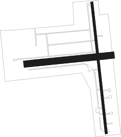
Runway info
Runway 17 / 35  | ||
| length | 765m (2510ft) | |
| bearing | 178° / 358° | |
| width | 15m (50ft) | |
| surface | asphalt | |
| displ threshold | 236m (774ft) / 176m (577ft) | |
| Runway 09 / 27 | ||
| length | 494m (1621ft) | |
| bearing | 89° / 269° | |
| width | 40m (130ft) | |
| surface | grass | |
Nearby beacons
| code | identifier | dist | bearing | frequency |
|---|---|---|---|---|
| FNT | FLINT VORTAC | 5.7 | 146° | 116.90 |
| PSI | DME | 24.2 | 142° | 111 |
| MB | OLSTE (SAGINAW) NDB | 29.5 | 317° | 257 |
| MBS | SAGINAW VOR/DME | 31.1 | 330° | 112.90 |
| SVM | SALEM VORTAC | 39.7 | 162° | 114.30 |
| MTC | SELFRIDGE (MOUNT CLEMENS) TACAN | 50.3 | 114° | 133.70 |
| MOP | MOUNT PLEASANT VOR/DME | 53.2 | 301° | 110.60 |
| DXO | DETROIT VOR/DME | 54 | 152° | 113.40 |
| JXN | DME | 55.7 | 219° | 115.45 |
| DM | SPENC (DETROIT) NDB | 56.6 | 144° | 223 |
| DT | REVUP (DETROIT) NDB | 58.3 | 158° | 388 |
| QG | WINDSOR NDB | 60.6 | 128° | 353 |
| RYS | GROSSE ILE (DETROIT) NDB | 63.9 | 146° | 419 |
| LFD | LITCHFIELD VOR/DME | 73 | 224° | 111.20 |
Disclaimer
The information on this website is not for real aviation. Use this data with the X-Plane flight simulator only! Data taken with kind consent from X-Plane 12 source code and data files. Content is subject to change without notice.