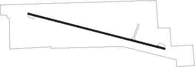
Springfield - Downtown
Airport details
| Country | United States of America |
| State | Missouri |
| Region | K3 |
| Airspace | Kansas City Ctr |
| Municipality | Springfield |
| Elevation | 1374ft (419m) |
| Timezone | GMT -6 |
| Coordinates | 37.22271, -93.24835 |
| Magnetic var | |
| Type | land |
| Available since | X-Plane v10.40 |
| ICAO code | 3DW |
| IATA code | n/a |
| FAA code | 3DW |
Communication
| Downtown CTAF/UNICOM | 122.800 |
Nearby Points of Interest:
Pythian Home of Missouri
-Lincoln School
-Ambassador Apartments
-Edward M. and Della C. Wilhoit House
-Bentley House
-Benton Avenue AME Church
-Commercial Street Historic District
-Woods-Evertz Stove Company Historic District
-Greene County Courthouse
-College Apartments
-D.M. Oberman Manufacturing Co. Building
-U.S. Customhouse and Post Office
-Franklin Springfield Motor Co. Building
-Keet-McElhany House
-Gottfried Furniture Company Building
-E. M. Wilhoit Building
-Holland Building
-Springfield Public Square Historic District
-Camp Manor Apartments
-Heer's Department Store
-Wise Feed Company Building
-Old Calaboose
-Finkbiner Building
-Day House
-Springfield Seed Co. Office and Warehouse
Nearby beacons
| code | identifier | dist | bearing | frequency |
|---|---|---|---|---|
| SGF | SPRINGFIELD VORTAC | 8.9 | 327° | 116.90 |
| DGD | DOGWOOD VORTAC | 21.4 | 118° | 109.40 |
| HRO | HARRISON VOR/DME | 54.3 | 178° | 112.50 |
| SHY | SUNSHINE (KAISER) VOR/DME | 57.9 | 38° | 108.40 |
| FLP | DME | 67.2 | 139° | 116.05 |
| RZC | RAZORBACK (FAYETTEVILLE) VORTAC | 72.1 | 222° | 116.40 |
Instrument approach procedures
| runway | airway (heading) | route (dist, bearing) |
|---|---|---|
| RWNVA | JERUP (94°) | JERUP 4000ft |
| RWNVA | MEVDY (86°) | MEVDY JERUP (11mi, 79°) 4000ft |
| RNAV | JERUP 4000ft HOSKO (4mi, 85°) 3200ft ZAMEV (2mi, 84°) 2700ft BOTHY (3mi, 105°) 1602ft (5561mi, 112°) 1775ft FANGA (5555mi, 292°) ETUNE (5mi, 129°) 4000ft ETUNE (turn) | |
| RWNVB | DGD (298°) | DGD ETUNE (11mi, 300°) 4000ft |
| RWNVB | ETUNE (296°) | ETUNE 4000ft |
| RNAV | ETUNE 4000ft FANGA (5mi, 309°) 3100ft POKAE (4mi, 285°) 1693ft (5559mi, 112°) 1780ft ZAMEV (5565mi, 292°) JERUP (6mi, 265°) 4000ft JERUP (turn) |
Disclaimer
The information on this website is not for real aviation. Use this data with the X-Plane flight simulator only! Data taken with kind consent from X-Plane 12 source code and data files. Content is subject to change without notice.