Excelsior Springs - Excelsior Springs Memorial
Airport details
| Country | United States of America |
| State | Missouri |
| Region | |
| Airspace | Kansas City Ctr |
| Municipality | Excelsior Springs |
| Elevation | 993ft (303m) |
| Timezone | GMT -6 |
| Coordinates | 39.33733, -94.19750 |
| Magnetic var | |
| Type | land |
| Available since | X-Plane v10.40 |
| ICAO code | 3EX |
| IATA code | n/a |
| FAA code | 3EX |
Communication
| Excelsior Springs Memorial AWOS (GPH/5.2 W) | 120.275 |
| Excelsior Springs Memorial UNICOM | 122.700 |
| Excelsior Springs Memorial KANSAS CITY Approach | 118.400 |
| Excelsior Springs Memorial KANSAS CITY Departure | 118.400 |
Nearby Points of Interest:
Hall of Waters
-Ligon Apartments
-Excelsior Springs Hall of Waters Commercial East Historic District
-First Methodist Church
-The Elms Historic District
-Excelsior Springs Hall of Waters Commercial West Historic District
-Watkins Woolen Mill State Park and State Historic Site
-James Brothers' House and Farm
-Claybrook House
-Missouri City Savings Bank Building and Meeting Hall
-Fort Osage
-Ray County Poor Farm
-Nebo Hill Archeological Site
-Watkins House
-Ray County Courthouse
-Jewell Hall
-Jewell-Lightburne Historic District
-Arthur-Leonard Historic District
-Frank Hughes Memorial Library
-Clay County Savings Association Building
-IOOF Liberty Lodge No. 49
-Miller Building
-South Liberty Courthouse Square Historic District
-Odd Fellows Home District
-Clinton House
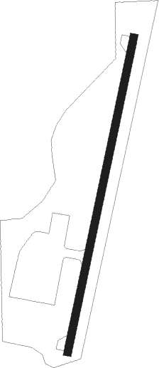
Runway info
| Runway 3 / 21 | ||
| length | 611m (2005ft) | |
| bearing | 21° / 201° | |
| width | 15m (50ft) | |
| surface | concrete | |
Nearby beacons
| code | identifier | dist | bearing | frequency |
|---|---|---|---|---|
| ANX | NAPOLEON VORTAC | 14.8 | 164° | 114 |
| BQS | BRAYMER VOR/DME | 23 | 48° | 115.35 |
| MCI | KANSAS CITY VORTAC | 25.2 | 264° | 113.25 |
| RN | HUGGY (KANSAS CITY) NDB | 30.4 | 267° | 416 |
| ST | TARIO (ST JOSEPH) NDB | 38.6 | 296° | 260 |
| PK | HERBB (OLATHE) NDB | 43.1 | 223° | 420 |
| AZN | AMAZON (SAINT JOSEPH) NDB | 46.4 | 308° | 233 |
| SZL | WHITEMAN (KNOB NOSTER) TACAN | 47 | 133° | 109.80 |
| STJ | SAINT JOSEPH (ST JOSEPH) VORTAC | 50.3 | 311° | 115.50 |
| JZ | NEWBN (LAWRENCE) NDB | 51.3 | 246° | 338 |
Instrument approach procedures
| runway | airway (heading) | route (dist, bearing) |
|---|---|---|
| RWNVB | CAULD (213°) | CAULD 2600ft |
| RNAV | CAULD 2600ft AMIXE (4mi, 213°) 2600ft 3EX (5mi, 213°) 1660ft (5600mi, 113°) 1660ft CAULD (5596mi, 293°) 2600ft CAULD (turn) |
Disclaimer
The information on this website is not for real aviation. Use this data with the X-Plane flight simulator only! Data taken with kind consent from X-Plane 12 source code and data files. Content is subject to change without notice.