Vivian
Airport details
| Country | United States of America |
| State | Louisiana |
| Region | K4 |
| Airspace | Ft Worth Ctr |
| Municipality | Caddo Parish |
| Elevation | 257ft (78m) |
| Timezone | GMT -6 |
| Coordinates | 32.86133, -94.01015 |
| Magnetic var | |
| Type | land |
| Available since | X-Plane v10.40 |
| ICAO code | 3F4 |
| IATA code | n/a |
| FAA code | n/a |
Communication
| Vivian CTAF/UNICOM | 122.800 |
| Vivian SHREVEPORT Approach/Departure | 119.900 |
| Vivian SHREVEPORT Approach/Departure | 121.400 |
Nearby Points of Interest:
Kansas City Southern Depot
-Kiblah School
-Hughes House
-Mimosa Hall
-The Grove
-Jefferson Ordnance Magazine
-Old United States Post Office and Courts Building
-Jefferson Historic District
-Presbyterian Manse
-Mathews-Powell House
-Cass County Courthouse
-Pleasant Hill School
-Shreveport Waterworks Pumping Station
-Kansas City Southern Railroad Bridge, Cross Bayou
-Petroleum Tower
-United States Post Office and Courthouse
-Strand Theatre
-Central Fire Station
-Shreveport Municipal Memorial Auditorium
-Huey P. Long House
-Bossier High School
-Scottish Rite Cathedral
-St. Mark's Episcopal Church
-Shreveport station
-B'Nai Zion Temple
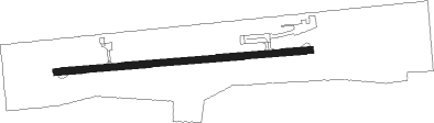
Runway info
| Runway 9 / 27 | ||
| length | 915m (3002ft) | |
| bearing | 90° / 270° | |
| width | 23m (75ft) | |
| surface | asphalt | |
Nearby beacons
| code | identifier | dist | bearing | frequency |
|---|---|---|---|---|
| EIC | BELCHER (SHREVEPORT) VORTAC | 11.4 | 114° | 117.40 |
| ATA | ATLANTA NDB | 17.1 | 323° | 347 |
| BAD | BARKSDALE (BOSSIER CITY) TACAN | 27.6 | 136° | 115.80 |
| EMG | ELM GROVE VORTAC | 34.7 | 138° | 111.20 |
| TXK | TEXARKANA VORTAC | 39.3 | 354° | 116.30 |
| TX | TECCO (TEXARKANA) NDB | 40.1 | 9° | 234 |
| RPF | CARTHAGE NDB | 43.3 | 203° | 332 |
| GGG | GREGG CO. (LONGVIEW) VORTAC | 46 | 239° | 112.90 |
| GG | VEELS (LONGVIEW) NDB | 46.6 | 243° | 410 |
| HPC | HOPE NDB | 54.5 | 23° | 362 |
Instrument approach procedures
| runway | airway (heading) | route (dist, bearing) |
|---|---|---|
| RW09 | DOGGE (149°) | DOGGE JUGEB (18mi, 178°) 2000ft HITIB (5mi, 179°) 2000ft |
| RW09 | HITIB (90°) | HITIB 2000ft |
| RW09 | WORKS (48°) | WORKS OYUTI (13mi, 26°) 2000ft HITIB (5mi, 359°) 2000ft |
| RNAV | HITIB 2000ft ICEDA (6mi, 90°) 1900ft 3F4 (5mi, 90°) 299ft JIMIB (11mi, 90°) 2000ft JIMIB (turn) | |
| RW27 | BEKEN (1°) | BEKEN WOVEL (25mi, 33°) 3100ft JIMIB (6mi, 360°) 2000ft |
| RW27 | DUBOW (185°) | DUBOW OVNAE (21mi, 148°) 2000ft JIMIB (5mi, 180°) 2000ft |
| RW27 | JIMIB (270°) | JIMIB 2000ft |
| RW27 | LUCEN (333°) | LUCEN WOVEL (22mi, 359°) 2100ft JIMIB (6mi, 360°) 2000ft |
| RNAV | JIMIB 2000ft WEGEV (6mi, 270°) 1900ft 3F4 (5mi, 270°) 299ft HITIB (11mi, 270°) 2000ft HITIB (turn) |
Disclaimer
The information on this website is not for real aviation. Use this data with the X-Plane flight simulator only! Data taken with kind consent from X-Plane 12 source code and data files. Content is subject to change without notice.