Grand Haven - Grand Haven Mem Airpark
Airport details
| Country | United States of America |
| State | Michigan |
| Region | K5 |
| Airspace | Chicago Ctr |
| Municipality | Grand Haven |
| Elevation | 604ft (184m) |
| Timezone | GMT -5 |
| Coordinates | 43.03405, -86.19817 |
| Magnetic var | |
| Type | land |
| Available since | X-Plane v10.40 |
| ICAO code | 3GM |
| IATA code | n/a |
| FAA code | 3GM |
Communication
| Grand Haven Mem Airpark CTAF/UNICOM | 122.700 |
| Grand Haven Mem Airpark MUSKEGON Approach/Departure | 119.800 |
Nearby Points of Interest:
Nathaniel and Esther (Savidge) Robbins House
-Battle Point Site
-Grand Trunk Western Railroad Grand Haven Coal Tipple
-Spoonville site
-Olive Township District No. 1 School
-Grand Rapids, Grand Haven and Muskegon Railway Depot
-Charles H. Hackley House
-Hume House
-Central Fire Station
-Muskegon Historic District
-Union Depot
-Muskegon YMCA Building
-Isaac Cappon House
-Holland Downtown Historic District
-Holland Old City Hall and Fire Station
-Egbert H. Gold Estate
-Old Wing Mission
-Hudsonville Christian School Building
-Dorr E. Felt Mansion
-Norton Mound Group
-All Saints Episcopal Church
-Warner P. Sutton House
-Lake Shore Chapel
-Berkey and Gay Furniture Company Factory
-Exhibitors Building
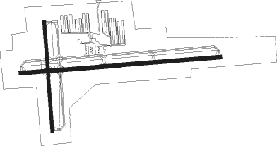
Runway info
Runway 9 / 27  | ||
| length | 1141m (3743ft) | |
| bearing | 90° / 270° | |
| width | 23m (75ft) | |
| surface | asphalt | |
| Runway 18 / 36 | ||
| length | 628m (2060ft) | |
| bearing | 180° / 0° | |
| width | 18m (60ft) | |
| surface | asphalt | |
Nearby beacons
| code | identifier | dist | bearing | frequency |
|---|---|---|---|---|
| MKG | MUSKEGON TACAN | 10.6 | 50° | 115.20 |
| VIO | VICTORY VOR/DME | 34.2 | 109° | 115.95 |
| PMM | PULLMAN VOR/DME | 34.3 | 171° | 112.10 |
| GR | KNOBS (GRAND RAPIDS) NDB | 36.9 | 100° | 263 |
| HIC | WHITE CLOUD VOR/DME | 38.7 | 42° | 117.60 |
| ELX | KEELER VOR/DME | 53.5 | 175° | 116.60 |
| AZO | KALAMAZOO VOR/DME | 55.7 | 141° | 109 |
| AZ | AUSTN (KALAMAZOO) NDB | 61.7 | 143° | 371 |
Instrument approach procedures
| runway | airway (heading) | route (dist, bearing) |
|---|---|---|
| RW09 | WASOG (90°) | WASOG 3000ft |
| RNAV | WASOG 3000ft SIBEE (13mi, 90°) 2100ft 3GM (5mi, 90°) 637ft (5238mi, 117°) 1004ft FIVLO (5227mi, 297°) 2700ft FIVLO (turn) | |
| RW27 | FIVLO (270°) | FIVLO 2700ft |
| RNAV | FIVLO 2700ft CIRBO (6mi, 270°) 2100ft 3GM (5mi, 270°) 627ft (5238mi, 117°) 1000ft WASOG (5256mi, 296°) 3000ft WASOG (turn) |
Disclaimer
The information on this website is not for real aviation. Use this data with the X-Plane flight simulator only! Data taken with kind consent from X-Plane 12 source code and data files. Content is subject to change without notice.