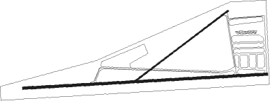
Grain Valley - East Kansas City
Airport details
| Country | United States of America |
| State | Missouri |
| Region | K3 |
| Airspace | Kansas City Ctr |
| Municipality | Grain Valley |
| Elevation | 833ft (254m) |
| Timezone | GMT -6 |
| Coordinates | 39.01464, -94.21486 |
| Magnetic var | |
| Type | land |
| Available since | X-Plane v10.40 |
| ICAO code | 3GV |
| IATA code | n/a |
| FAA code | n/a |
Communication
| East Kansas City CTAF/UNICOM | 122.800 |
| East Kansas City KANSAS CITY Approach/Departure | 118.400 |
Nearby Points of Interest:
Andrew Drumm Institute
-Jackson County Courthouse
-Saint Paul's Episcopal Church
-Kritser House
-Fort Osage
-Jackson County Jail and Marshal's House
-Odessa Ice Cream Company Building
-Rice-Tremonti House
-Nebo Hill Archeological Site
-Missouri City Savings Bank Building and Meeting Hall
-Odd Fellows Home District
-Harry S. Truman National Historic Site
-Clinton House
-Arthur-Leonard Historic District
-Jewell Hall
-Jewell-Lightburne Historic District
-South Liberty Courthouse Square Historic District
-Parade Park Maintenance Building
-Frank Hughes Memorial Library
-Clay County Savings Association Building
-IOOF Liberty Lodge No. 49
-Miller Building
-McConahay Building
-F. W. Woolworth Building
-Dougherty–Prospect Heights Historic District

Nearby beacons
| code | identifier | dist | bearing | frequency |
|---|---|---|---|---|
| ANX | NAPOLEON VORTAC | 6.2 | 47° | 114 |
| PK | HERBB (OLATHE) NDB | 29 | 243° | 420 |
| MCI | KANSAS CITY VORTAC | 29.2 | 297° | 113.25 |
| RN | HUGGY (KANSAS CITY) NDB | 34.2 | 294° | 416 |
| SZL | WHITEMAN (KNOB NOSTER) TACAN | 35.2 | 113° | 109.80 |
| BQS | BRAYMER VOR/DME | 40.2 | 29° | 115.35 |
| JZ | NEWBN (LAWRENCE) NDB | 44.2 | 264° | 338 |
| BUM | BUTLER VORTAC | 46.4 | 200° | 115.90 |
| ST | TARIO (ST JOSEPH) NDB | 51 | 314° | 260 |
| AZN | AMAZON (SAINT JOSEPH) NDB | 61.3 | 321° | 233 |
| STJ | SAINT JOSEPH (ST JOSEPH) VORTAC | 65.6 | 323° | 115.50 |
Instrument approach procedures
| runway | airway (heading) | route (dist, bearing) |
|---|---|---|
| RW09 | GIRFA (91°) | GIRFA 3100ft |
| RNAV | GIRFA 3100ft YICHO (6mi, 91°) 2600ft ZULSA (2mi, 91°) 1920ft 3GV (3mi, 91°) 849ft (5602mi, 112°) 1235ft GOKLY (5592mi, 293°) 3100ft GOKLY (turn) | |
| RW27 | GOKLY (271°) | GOKLY 3100ft |
| RNAV | GOKLY 3100ft YIXER (5mi, 271°) 2600ft ZOBUG (2mi, 271°) 1960ft 3GV (3mi, 271°) 864ft (5602mi, 112°) 1235ft GIRFA (5612mi, 292°) 3100ft GIRFA (turn) |
Disclaimer
The information on this website is not for real aviation. Use this data with the X-Plane flight simulator only! Data taken with kind consent from X-Plane 12 source code and data files. Content is subject to change without notice.