North Terre Haute - Sky King
Airport details
| Country | United States of America |
| State | Indiana |
| Region | K5 |
| Airspace | Indianapolis Ctr |
| Municipality | Vigo County |
| Elevation | 496ft (151m) |
| Timezone | GMT -5 |
| Coordinates | 39.54779, -87.37735 |
| Magnetic var | |
| Type | land |
| Available since | X-Plane v10.40 |
| ICAO code | 3I3 |
| IATA code | n/a |
| FAA code | n/a |
Communication
| Sky King CTAF/UNICOM | 122.800 |
| Sky King HULMAN Approach/Departure | 125.450 |
Nearby Points of Interest:
Collett Park Neighborhood Historic District
-Twelve Points Historic District
-Butternut Hill
-Foley Hall
-Eugene V. Debs Home
-Terre Haute Fire Station No. 8
-Vigo County Home for Dependent Children
-Terre Haute Masonic Temple
-Ohio Boulevard-Deming Park Historic District
-Condit House
-Terminal Arcade
-Terre Haute Post Office and Federal Building
-810 Wabash Avenue
-Chamber of Commerce Building
-Wabash Avenue-East Historic District
-Wabash Avenue-West Historic District
-House at 823 Ohio Street
-Wabash Theater
-First National Bank
-Indiana Theatre
-Citizens' Trust Company Building
-Building at 510–516 Ohio Street
-Building at 23–27 S. Sixth Street
-Star Building
-House at 209–211 S. Ninth Street
Runway info
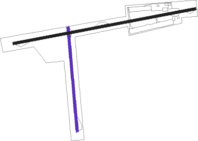
| Runway 18 / 36 | ||
| length | 605m (1985ft) | |
| bearing | 179° / 359° | |
| width | 15m (50ft) | |
| surface | asphalt | |
| displ threshold | 15m (49ft) / 88m (289ft) | |
Runway 9 / 27  | ||
| length | 1082m (3550ft) | |
| bearing | 85° / 265° | |
| width | 15m (50ft) | |
| surface | asphalt | |
| displ threshold | 0m (0ft) / 248m (814ft) | |
Nearby beacons
| code | identifier | dist | bearing | frequency |
|---|---|---|---|---|
| TTH | TERRE HAUTE VORTAC | 6.9 | 115° | 115.30 |
| HU | YINNO (TERRE HAUTE) NDB | 9.6 | 187° | 245 |
| CFJ | CRAWFORDSVILLE NDB | 33.6 | 47° | 388 |
| PLX | PALESTINE (ROBINSON) NDB | 34.3 | 206° | 391 |
| MTO | DME | 42.3 | 266° | 109.40 |
| OOM | HOOSIER (BLOOMINGTON) VORTAC | 42.9 | 118° | 110.20 |
| CM | VEALS (CHAMPAIGN/URBANA) NDB | 44.8 | 297° | 407 |
| DN | JULIP (DANVILLE) NDB | 45.1 | 348° | 332 |
| DNV | DANVILLE VORTAC | 45.5 | 346° | 111 |
| LWV | DME | 47.8 | 196° | 108.80 |
| CMI | CHAMPAIGN VORTAC | 50.7 | 298° | 110 |
| LA | EARLE (LAFAYETTE) NDB | 54.8 | 20° | 401 |
| OLY | OLNEY NDB | 62 | 224° | 272 |
Instrument approach procedures
| runway | airway (heading) | route (dist, bearing) |
|---|---|---|
| RWNVA | CADOX (85°) | CADOX 6000ft CADOX (turn) 3000ft |
| RWNVA | JIXED (60°) | JIXED CADOX (8mi, 352°) 3000ft |
| RWNVA | PROGS (109°) | PROGS CADOX (8mi, 172°) 3000ft |
| RNAV | CADOX 3000ft HESEK (8mi, 85°) 2300ft SKITE (3mi, 85°) 1480ft 3I3 (3mi, 86°) 533ft (5284mi, 114°) 1400ft CADOX (5297mi, 294°) 3000ft CADOX (turn) |
Disclaimer
The information on this website is not for real aviation. Use this data with the X-Plane flight simulator only! Data taken with kind consent from X-Plane 12 source code and data files. Content is subject to change without notice.