Varnville - Hampton County
Airport details
| Country | United States of America |
| State | South Carolina |
| Region | K7 |
| Airspace | Jacksonville Ctr |
| Municipality | Varnville |
| Elevation | 111ft (34m) |
| Timezone | GMT -5 |
| Coordinates | 32.86650, -81.08100 |
| Magnetic var | |
| Type | land |
| Available since | X-Plane v10.40 |
| ICAO code | 3J0 |
| IATA code | n/a |
| FAA code | n/a |
Communication
| Hampton County CTAF | 122.900 |
Nearby Points of Interest:
Hattie J. Peeples House
-Hampton County Jail
-American Legion Hut
-Cohasett
-Hampton County Courthouse
-Oak Grove
-Virginia Durant Young House
-John Lawton House
-Copeland House
-Roselawn (Allendale, South Carolina)
-Gravel Hill Plantation (Allendale, South Carolina)
-The Pineland
-Auldbrass Plantation
-Erwin House (Allendale, South Carolina)
-J.C. Richardson House
-Colding-Walker House
-Colleton County Courthouse
-Old Colleton County Jail
-Walterboro Library Society Building
-Walterboro Historic District
-Georgia Welcome Center
-Jasper County Courthouse
-Sinclair Service Station
-Honey Hill-Boyd's Neck Battlefield
-White Hall Plantation House Ruins and Oak Avenue
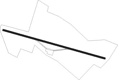
Runway info
| Runway 11 / 29 | ||
| length | 1092m (3583ft) | |
| bearing | 107° / 287° | |
| width | 18m (60ft) | |
| surface | asphalt | |
Nearby beacons
| code | identifier | dist | bearing | frequency |
|---|---|---|---|---|
| ALD | ALLENDALE VOR | 13.7 | 305° | 116.70 |
| JYL | SYLVANIA NDB | 29 | 247° | 245 |
| NBC | BEAUFORT TACAN | 29.6 | 137° | 110.50 |
| BZ | BULLO (STATESBORO) NDB | 40 | 232° | 407 |
| DYB | DORCHESTER COUNTY(SUMMERVILLE) NDB | 42.1 | 76° | 365 |
| SAV | SAVANNAH VORTAC | 43.6 | 189° | 115.95 |
| VAN | VANCE VORTAC | 48.4 | 46° | 110.40 |
| CH | ASHLY (CHARLESTON) NDB | 50 | 84° | 329 |
| AG | BUSHE (AUGUSTA) NDB | 50.3 | 296° | 233 |
| SVN | HUNTER (SAVANNAH) VOR/DME | 51.4 | 184° | 111.60 |
| SV | WASSA (SAVANNAH) NDB | 52 | 174° | 335 |
| AIK | AIKEN NDB | 55.8 | 323° | 347 |
| EMR | EMORY (AUGUSTA) NDB | 58.3 | 303° | 385 |
| CAE | COLUMBIA VORTAC | 59.5 | 2° | 114.70 |
| MNI | MANNING NDB | 61.7 | 50° | 381 |
Disclaimer
The information on this website is not for real aviation. Use this data with the X-Plane flight simulator only! Data taken with kind consent from X-Plane 12 source code and data files. Content is subject to change without notice.