Greensboro - Greene County Regl
Airport details
| Country | United States of America |
| State | Georgia |
| Region | K7 |
| Airspace | Atlanta Ctr |
| Municipality | Greene County |
| Elevation | 687ft (209m) |
| Timezone | GMT -5 |
| Coordinates | 33.59797, -83.13825 |
| Magnetic var | |
| Type | land |
| Available since | X-Plane v10.40 |
| ICAO code | 3J7 |
| IATA code | n/a |
| FAA code | n/a |
Communication
| Greene County Regl AWOS-3 | 124.525 |
| Greene County Regl CTAF/UNICOM | 122.800 |
| Greene County Regl ATLANTA Approach/Departure | 127.500 |
Approach frequencies
| LOC | RW25 | 110.9 | 18.00mi |
Nearby Points of Interest:
Greene County Courthouse
-Siloam Historic District
-Jefferson Hall
-A. H. Stephens State Park
-Liberty Hall
-Kettle Creek Battlefield
-Rock Eagle Effigy Mound
-Elder's Mill Covered Bridge and Elder Mill
-Carter-Newton House
-Crawford Depot
-Tupper-Barnett House
-Old Jail (Washington, Georgia)
-Campbell-Jordan House
-Mary Willis Library
-Holly Court
-Wilkes County Courthouse
-The Cedars
-Hard Labor Creek State Park
-Camak House
-Lucy Cobb Institute
-Gospel Pilgrim Cemetery
-Joseph Henry Lumpkin House
-Ware-Lyndon house
-Cobbham Historic District
-Henry W. Grady House
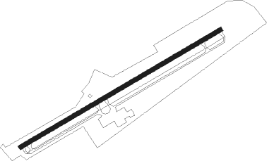
Runway info
| Runway 7 / 25 | ||
| length | 1678m (5505ft) | |
| bearing | 68° / 248° | |
| width | 30m (100ft) | |
| surface | asphalt | |
| displ threshold | 34m (112ft) / 0m (0ft) | |
| blast zone | 46m (151ft) / 53m (174ft) | |
Nearby beacons
| code | identifier | dist | bearing | frequency |
|---|---|---|---|---|
| VV | JUNNE (GREENSBORO) NDB | 6.5 | 67° | 353 |
| AHN | ATHENS VOR/DME | 22.9 | 332° | 109.60 |
| AA | CEDAR (THOMSON) NDB | 26.5 | 97° | 341 |
| UMB | CULVR (MILLEDGEVILLE) NDB | 26.8 | 183° | 380 |
| BMW | BARROW COUNTY (WINDER) NDB | 30.2 | 307° | 404 |
| VOF | ALCOVY (COVINGTON) NDB | 32.2 | 273° | 370 |
| TX | GWNET (LAWRENCEVILLE) NDB | 44.1 | 300° | 419 |
| IRQ | COLLIERS VORTAC | 49.2 | 84° | 113.90 |
| ELW | ELECTRIC CITY (ANDERSON) VORTAC | 52.3 | 23° | 108.60 |
| FKV | FLOWERY BRANCH (GAINESVILLE) NDB | 52.7 | 308° | 365 |
| MCN | MACON VORTAC | 60.1 | 209° | 114.20 |
| WRB | ROBINS (WARNER ROBINS) TACAN | 61.8 | 205° | 135.30 |
| GRD | GREENWOOD VORTAC | 62.8 | 56° | 115.50 |
| EEX | EMANUEL COUNTY (SWAINSBORO) NDB | 65.7 | 144° | 309 |
Instrument approach procedures
| runway | airway (heading) | route (dist, bearing) |
|---|---|---|
| RW07 | BEYLO (351°) | BEYLO GOBYI (14mi, 299°) 2300ft ETZOP (5mi, 330°) 2300ft |
| RW07 | ETZOP (68°) | ETZOP 2300ft |
| RW07 | GLOSS (64°) | GLOSS ETZOP (8mi, 58°) 2300ft |
| RW07 | MADDI (104°) | MADDI JEVIN (5mi, 173°) 2300ft ETZOP (5mi, 150°) 2300ft |
| RNAV | ETZOP 2300ft AVSEW (7mi, 68°) 2300ft 3J7 (5mi, 68°) 712ft (5062mi, 112°) 1090ft EXJAN (5052mi, 292°) 2300ft EXJAN (turn) | |
| RW25 | EXJAN (248°) | EXJAN 2300ft |
| RNAV | EXJAN 2300ft AYEPI (7mi, 248°) 2300ft PRODS (3mi, 248°) 1280ft 3J7 (2mi, 248°) 744ft (5062mi, 112°) 981ft ETZOP (5073mi, 292°) 2300ft ETZOP (turn) |
Disclaimer
The information on this website is not for real aviation. Use this data with the X-Plane flight simulator only! Data taken with kind consent from X-Plane 12 source code and data files. Content is subject to change without notice.